
Surfing and Life at ‘Rincon Point,’ a New Book
It was Shuku when a band of nearly 300 Chumash lived on the point of land that today marks the boundary between Santa Barbara and Ventura counties. It became Rancheria San Mateo after the Spanish settled the area in 1782. It became El Rincon (the corner) after the Mexican governor of Alta California granted the point and over 4,000 acres to presidio veteran Teodoro Arellanes. In 1855 Arellanes deeded the rancho to his son-in-law, Mateo Henry Biggs, who had arrived at the brink of American ownership of California. Biggs sold off hundreds of acres of the rancho, opening the way for over 150 years of history leading to the Rincon Point of today.
Carpinteria natives Vincent Burns and Stephen Bates have chronicled that history in a new “Images of America” book that includes maps and hundreds of photographs, many collected from the families of longtime residents of Carpinteria. Chock full of personal reminiscences, the book shows the evolution of the area fostered by changes in transportation and the growth of the highway.
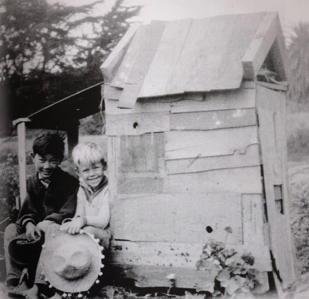
Stories about life on the Rincon include that of the Ota family, who leased land from the Bates and also farmed their own land in Carpinteria. The Bates and Ota children became great friends. When the Otas were interned during WWII, the Bates family took care of their property and visited them in the camps. Kijuro Ota had built a prosperous produce business before the war; afterward, they returned and were able to resume farming but never achieved their earlier success. My favorite photo of this section is of Kenji Ota and Bobby Bates wearing beamish smiles while sitting by the most ramshackle playhouse ever built but obviously created by them. (The way all playhouses should be.)
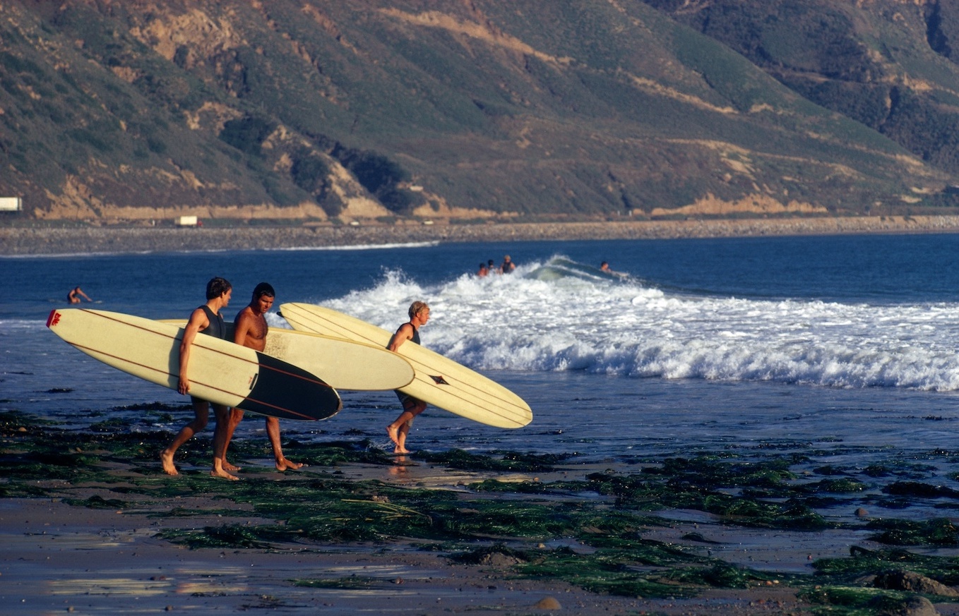
By the 1960s, the Rincon had become world famous as a surfing destination. I grew up in the San Fernando Valley, so I was a Valley Girl, but no ho-daddy. I remember tying my 9’6’’ Bing surfboard with its tapered balsa wood stringer to our family’s 1954 two-toned Belair Chevy with Powerglide stick shift. A time or two, we headed to the Rincon. Bates and Burns have dozens of stories and photographs of the surfing life of Rincon Point.
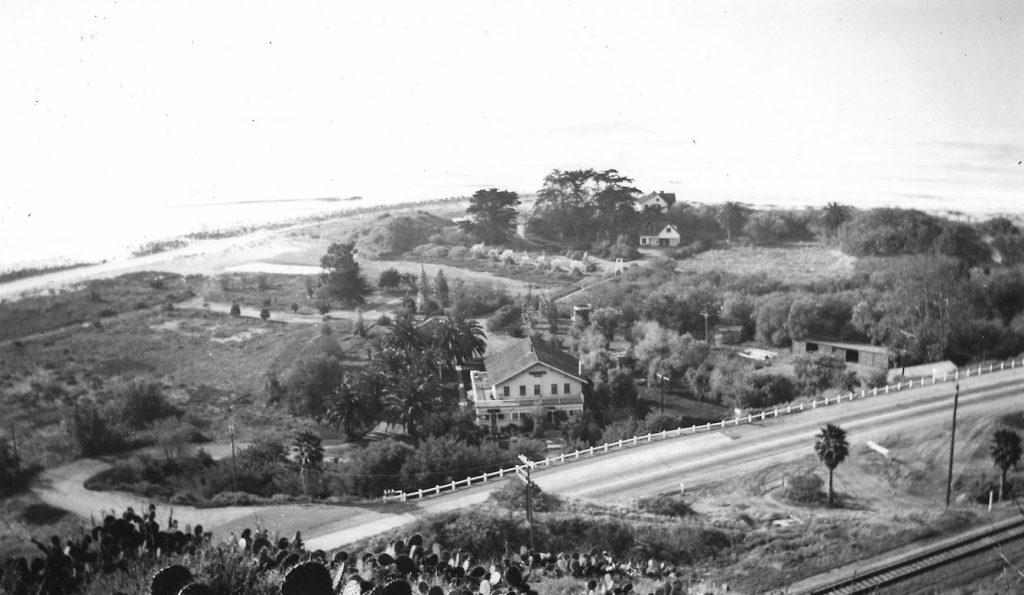
Bates and Burns also have aerial images of the development of the point itself. In the 1920s a few small beach cottages, a small group of farmhouses and outbuildings lining the cantaloupe fields, and the Merryland Inn, a bootlegger’s haven despite repeated raids, were all that occupied the site. Today, though many original families have retained their older beach homes, the farmland of the point has grown into over 80 homesites behind a private gate. The lands west of the point are open to the public as Rincon Beach County Park; the lands to the east of the point are open to the public as Rincon Point State Beach.
Burns and Bates will give a slide talk on their new book at the Ojai Library on January 14 from 1-2 pm. (Call 805-646-1639 for more information.) They will speak at the Carpinteria Community Library on January 15, from 3-4:30 pm. (Call 805-684-4314 for more information.)
Images of America’s Rincon Point is available at Chaucer’s Books, 3321 State Street, Santa Barbara, and at Tecolote Book Shop, 1470 East Valley Road, Montecito.
You might also be interested in...


