
Embracing the Loam
Snow flurries, hail, and intermittent rain was just enough to dampen the top layer of loam along the serpentine spine of the Caliente Ridge, the Caliente Mountains being a west-to-east uplifting mountain range in the remote southeast corner of San Luis Obispo County.
While mountain biking up the winding Caliente Ridge Road, a dense canopy of smoky gray storm clouds swirled above aided by chilly, piercing gale force winds. As I ascended well above the sweeping Carrizo Plain National Monument and the Selby Campground, I left behind the semi-arid grasslands pushing upward into a forest of juniper woodland scrub, surrounded by one of the most sparsely populated regions of California.
Mountain Forecast
It was a crapshoot gauging weather reports, especially in one of the more remote regions of the state, but there appeared to be a small, favorable weather window for mountain biking the 16.9-mile, out-and-back route out to Caliente Mountain and its Wilderness Study Area (WSA).
At 5,106 feet tall, Caliente Mountain is the highest peak in San Luis Obispo County. Ecologically, Caliente Mountain is botanically rich with juniper woodlands and Tucker’s oak groves. Wildlife abounds from roadrunner and mountain quail to black-tailed deer, black bear, and mountain lion. Endangered California condors are nearby and occasionally soar overhead in the afternoon thermal updrafts.
The WSA encompasses 35,600 acres of the 250,000-acre Carrizo Plain National Monument. While mountain biking above the grassland biosphere, there was a distinct realization that this incredible monument not only encompasses the sweeping grasslands, but also two mountain ranges bordering this unique biome.
The contrast in ecosystems was stunning and noticeable as I continued my ascent toward the Caliente Ridgeline. From that knife ridge a whole new perspective morphed into the complexities of California Coastal Ranges surrounding the Caliente Mountains. The Sierra Madre Mountains cloaked in dense chaparral dominated the western horizon, the Cuyama Valley and Highway 166 separating the two ranges. To the southeast, Mount Pinos stood taller than any other peak in the region. At 8,847 feet, it’s the highest peak in the Los Padres National Forest. To the east, on the other side of the Carrizo Plain, the seemingly barren Temblor Range jutted prominently from the grassland floor above the San Andreas Fault.
I had also noticed an extreme dip in temperature now hovering in the low 30s. However, with storm clouds still billowing in the north and bands of rain pelting the Sierra Madre to the southwest, I still felt as if I could make it to the Caliente summit and beat any inclement weather.
Dirty by Nature
Once within the WSA, the dirt road melded into a rolling single-track trail. First, I buzzed by a repeater station, then a bedraggled old cattle camp and finally a unique contraption at the bottom of a gully that ended up being a corrugated metal platform that works as a cistern, essentially a water source for any thirsty, mountain wildlife.
As I approached the summit, the trail became more challenging to ride, more sand in the steeper sections of the route. Reluctantly I left my bike beneath a juniper and hiked the rest of the way.
The summit was a triangular shaped uplift of lichen-covered sandstone and at its apex lied what was left of a WWII lookout for Japanese planes potentially aiming for nearby oilfields. It collapsed over a decade ago, weather-beaten and in shambles, but a sign-in box was there for peak baggers to scrawl their names into, a moment in time on a far-flung meridian.
My moment on the summit was brief. Foreboding weather had arrived, quicker than I had anticipated. Visibility was almost nil. The canopy of dark clouds had engulfed not only the summit, but the entire eight-mile-long Caliente Ridge. I ran with my camera pack back to my bike. From there a mixture of snow showers, rain, and a couple of bouts of hail mucked up the trail just enough to make mountain biking impossible on the rolling ascents.
The moisture had dampened the top layer of loam sticking to my tires like cement. Even pushing my bike was a real effort, to the point where my bike would not budge at all, dirt caking the treads until I removed enough muck to continue forward. That only allowed about 10 paces at a time before I was forced to remove more dirt. Sometimes I elected to carry my bike as my trail shoes collected an inch of mud along my ridgeline slog.
Downhills were a grateful reprieve from the mudslinging, allowing me to ride fast enough for the loam to spin off the treads. That meant eating plenty of dirt, my eyes already welling up with moisture and more than enough dirt finding my nostrils.
Grassland Descent
As I raced along Caliente Ridge as best I could, I anticipated my first grassland visual. What would I see first? I needed something I knew well, a point of reference to energize me, pushing me through the mud, while dipping below a clouded canopy and a warm sleeping bag awaiting at Selby Camp.
The ridge descended sharply, as I startled a perched golden eagle. The first thing I saw was the gritty row of angular sandstone slabs at Selby Rocks. My eyes welled up from the frigid, mountain air as I S-turned down the Caliente Mountains. Puffy clouds hovered above Soda Lake, and I was forced to pull off into several turnouts reveling in the jaw-dropping grassland vistas.
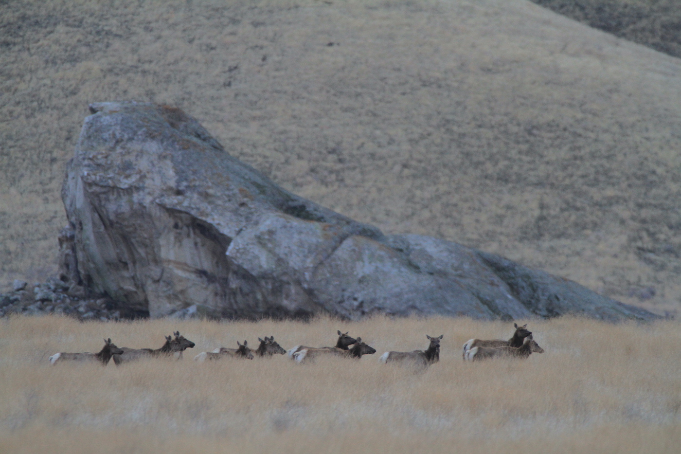
At each pullout my camera was in one hand and binoculars in the other, long lines of tule elk herds browsed the tan, beige, and brown ecosphere below. Suddenly I wasn’t cold anymore, and the mud was soon forgotten.


