
The People Behind Montecito’s Roads Part I
While Montecito’s roads were a nameless, mazelike mess in the 1870s, by 1899, with the introduction of Rural Free Delivery postal service, order and identification began to be placed on the street system. (See MJ “Early Roads in Montecito” July 18, 2019.) All would remain dirt roads, however, until 1909, when the first few roads through Montecito were paved as part of the Good Roads Movement that was gaining steam in America. As Montecito grew and roads were added, several of them were named to honor its pioneer residents.
North and South Jameson Lane are named for John Alexander Jameson, an attorney from Illinois who moved to Montecito in 1919 where he and his wife, Janet Strong Jameson, immersed themselves in community betterment, beautification, and cultural activities. Jameson’s concern over an adequate water supply for Montecito inspired him to join in the creation of the Montecito County Water District in 1922. For his leadership in this regard, the lake behind Juncal Dam was named for him – Jameson Lake.
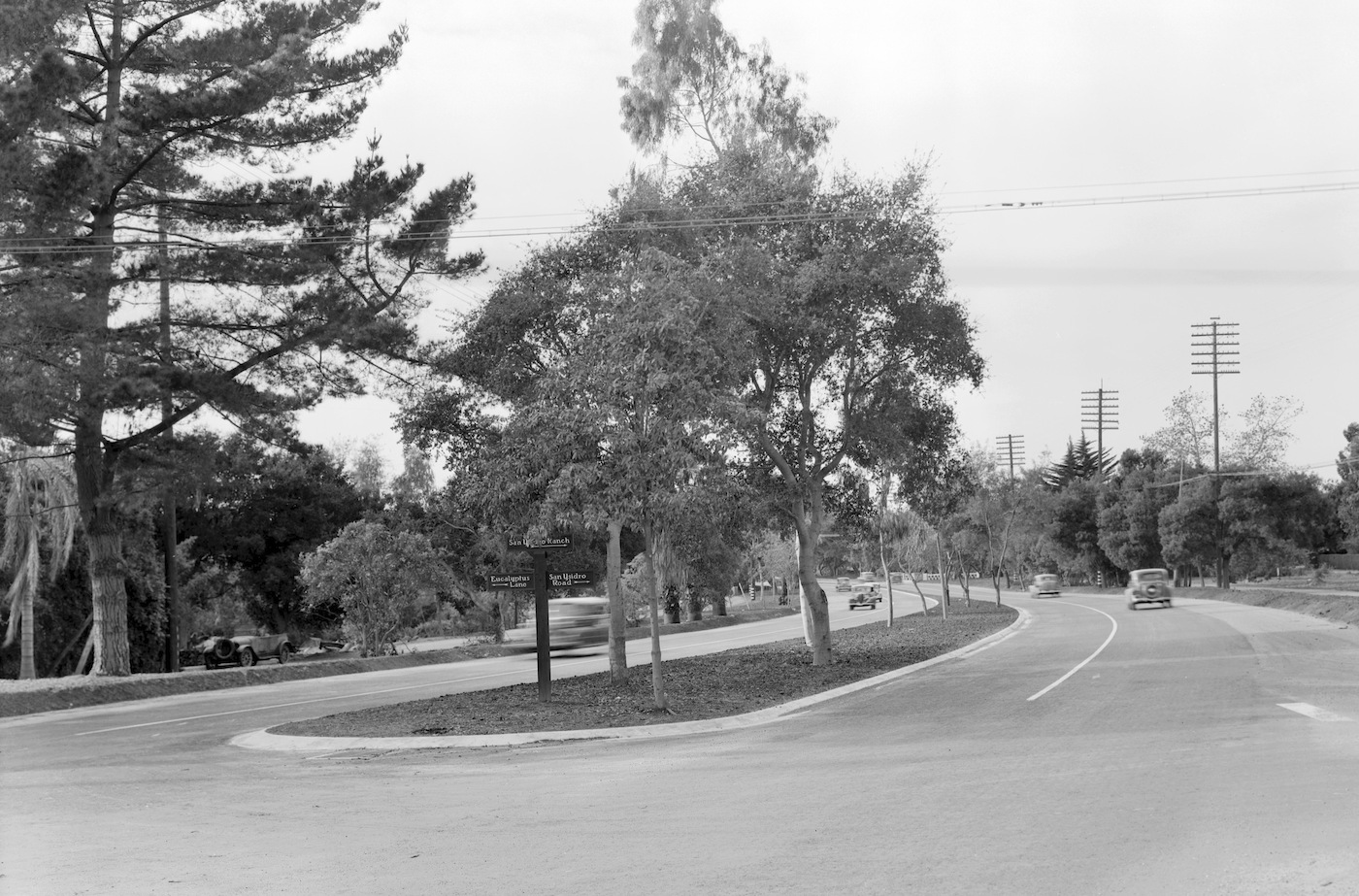
The roads, however, are named for his leadership in promoting the establishment of the Montecito Parkway. As a County Planning Commissioner (an organization which he helped establish), Jameson was at the helm of creating a road beautification project that was a response to the State’s plan to widen Highway 101 to four lanes as well as the rampant growth of shabby business establishments along the stretch of highway that is today’s Coast Village Road.
Jameson and his fellow Commissioners wanted to restrict businesses to one section of the road and create a triple roadway — one to carry the noisy and noxious highway traffic and two to flank the highway. They planned to shield the residential area from the highway with hedges, trees and other plantings. The highway itself was to have an attractively landscaped median strip. The plan was approved in 1930 but not completed until 1948. The two parallel roads were named to honor the man who had worked tirelessly to protect, enhance, and beautify Montecito.
Park Lane
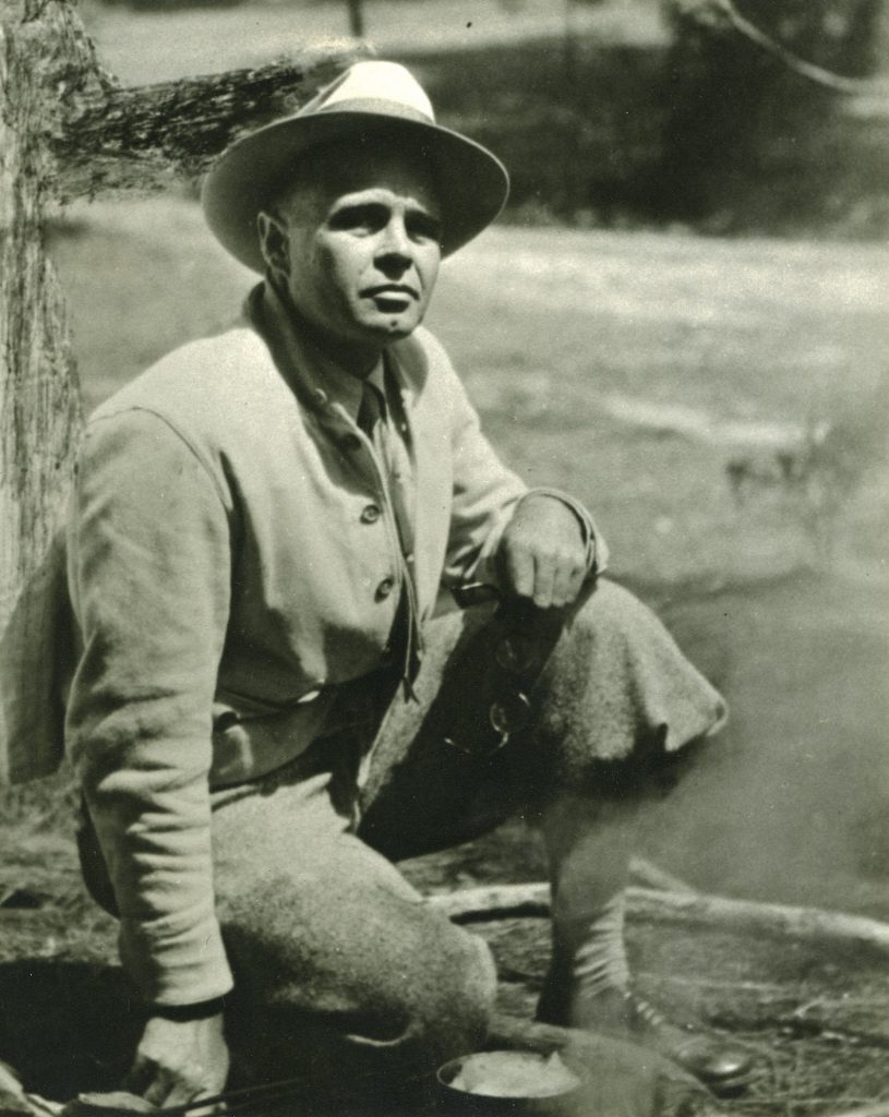
Dr. Charles Caldwell Park and family moved to Montecito in 1893 and purchased 27 acres of land north of today’s Park Lane. They soon became an integral part of the social, cultural, and philanthropic life in Santa Barbara and Montecito. Helen Park joined the St. Cecilia Club (today’s Cecilia Fund), which raised funds to furnish a free bed at the hospital for those without means, and Dr. Park often gave his medical aid to families who couldn’t afford care.
Over the years, Helen Park would promote a new Cottage Hospital (built in 1913) and established the Montecito Home Club (which later became the YMCA). Both Parks worked to preserve the Spanish culture of their neighbors by holding annual Christmas gatherings of Montecito’s Spanish doñas at the Park home. Park learned to speak Spanish, and, inspired by the stories told by his Spanish friends, wrote two books relating these tales.
When WWI began, Park and his family volunteered to establish an American Canteen in Tours, France for the YMCA. After the war, he became head of the committee that greeted the returning soldiers to Santa Barbara. Members of the Park family remained in Montecito for many years and continued their contributions to the greater community. Park Lane, which once led to their estate, was one of 25 roads officially named in 1899 so that Montecito could receive RFD postal service.
Sheffield Drive
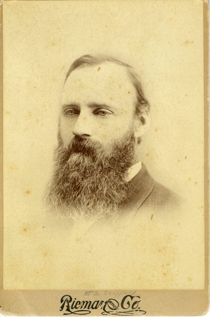
Eugene S. Sheffield arrived in Santa Barbara in 1875 and promptly joined W.M. Eddy and C.A. Edwards in forming the Santa Barbara County Bank. Sheffield and Edwards invested in large tracts of land in Montecito, much of it at the base of the mountains and along Mountain Drive.
As the population of Santa Barbara and Montecito increased, the lack of an adequate water supply reached crisis proportions. A private water company supplied water to Santa Barbara, and several private water companies formed in Montecito to drill horizontal wells. Those relying on creek flow, however, objected, and the courts were awash with water rights litigation.
Sheffield initiated the formation of a municipal water system in Santa Barbara. He became one its first water commissioners, and, along with Charles Frederick Eaton, donated land in Cold Spring Canyon for a tunnel which was bored between 1896 and 1903 and whose waters were delivered into the city system. With continuing litigation challenging the city tunnel, however, and the water supply still not adequate, Sheffield supported the audacious idea of drilling right through the mountain to tap into the Santa Ynez River where a dam would be built to create a reservoir. Though the tunnel was drilled between 1904 and 1912, the system was not complete until Gibraltar Dam was finished in 1920. (Sheffield Reservoir, on this side of the mountain, is named to honor him.)
In 1903, Sheffield and Ralph Radcliffe Whitehead, the owner of the Arcady estate in Montecito, laid out a road leading from the County Highway to Romero Canyon, where Whitehead was drilling a tunnel for a new water company. This road also facilitated travel for residents living in the eastern part of Montecito. It washed out during the floods of 1904 and closed for over a year before repairs were completed in 1906. At that time, it was named Sheffield Drive to honor the memory of Eugene S. Sheffield, who had died the previous year.
Presidio Pensioneers
When the soldiers of the Santa Barbara Presidio retired, they were granted land in the wilderness of El Montecito in lieu of pensions. After California became part of the United States, the Common Council of the town offered land grants of up to 40 acres per person for $1 per acre. Many of the descendents of the Presidio soldiers laid claim to these large tracts of land as did American land speculators and hopeful Yankee farmers. Four roads in Montecito retain the names of these early Spanish families.
Ayala Lane is a tiny road heading north off Ashley Road. In 1786, Jose Calixto Ayala, a soldado de cuera, and Juana Vitala Feliz became the first couple to be married at the Santa Barbara Presidio. Juan Capistrano Ayala was their 13th child. Juan ended up living in Montecito where he became a farmer and raised his family.
Juan Ayala’s obituary reveals the high regard in which he was held. “Don Juan was a benevolent Californian of the old school, highly esteemed for his piety and charitable acts, and his life was one of industry. He took a deep interest in church matters and ever endeavored to spread sunshine and gladness among his neighbors.”
Juan’s son, Juan Pablo Ayala, became a saloonkeeper in Spanish Town, that section of East Valley Road that dips down to cross Montecito Creek. He and Victor Juarez shared the business and even had Crown Distillery create a special label for Ayala & Juarez whiskey, which was “bottled expressly for family and medicinal use.” Given the contentious history of the legality of liquor in Montecito (the community had voted to go dry in 1874 under a local option law), the medicinal claim was wise. Especially with the 1883 WCTU and 1895 Anti Saloon League gaining ground in the area and a vote on the issue coming up in 1907.
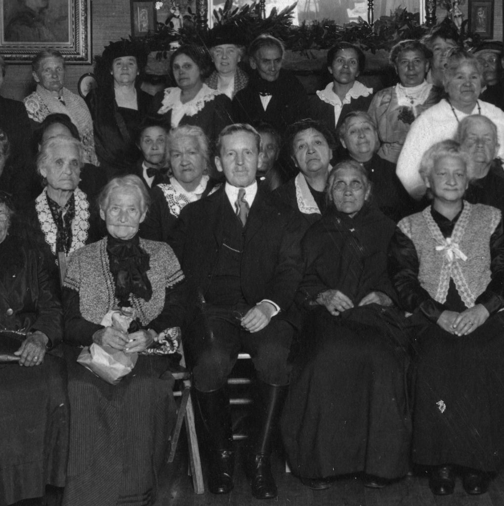
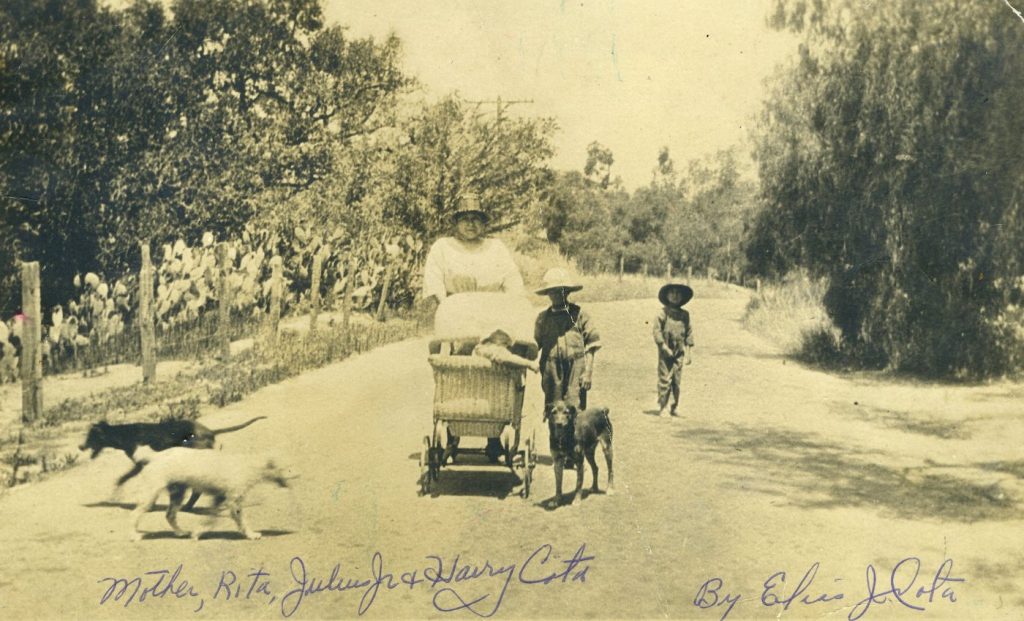
Cota Lane is named for the enclave of the descendents of Andres de Cota who together with his son, Pablo Antonio Cota, came to California with the Portola Expedition of 1769. Alferez Pablo Antonio stayed on to work in the founding and early development of several missions in California. In 1782, he was part of the company that founded the Santa Barbara Presidio. He served as acting commandante of the Presidio in 1797, and when he died in 1800, he was buried in the Presidio cemetery.
In 1880, United States Census records showed 26 people with the surname Cota living in Montecito. The eldest, 80-year-old José Maria Cota, was Pablo’s grandson and listed his occupation as vaquero. Members of the Cota family continued to live in this area into the 21st century.
Romero Canyon Road takes its name from brothers Mariano and Apolinario Romero, who each claimed homesteads in the canyon in 1880 and 1891 respectively. Mariano built a four-room house in the canyon and planted grapevines and fruit trees, mostly oranges and apples. His children rode horseback to the Ortega School located at the base of the road where it met today’s East Valley. At one time, Mariano also ran a saloon in Spanish Town.
The Romero presence in Montecito, however, dates back much further. Juan Maria Romero, born at the Royal Presidio in Loreto, Baja California in 1747, was a member of the colonizing expedition that escorted los pobladores (settlers) to Los Angeles and Santa Barbara in 1788. His wife and children accompanied him, and he served as a soldado de cuera at the Presidio in Santa Barbara. Though Juan Maria Romero died at Mission San Fernando Rey in 1816, several of his children lived their lives in Santa Barbara and Montecito, and his son, Jose Antonio Romero, also became a soldier of the Presidio. (Mariano and Apolinario were Juan Maria’s grandsons.)
When the Common Council of Santa Barbara opened the unclaimed portions of Montecito for purchase, the Romero clan a was already well established in two enclaves, one on Romero Hill (off today’s Miramonte Drive, which itself was named for the community hall the Romeros built) and the other in Spanish Town. Various Romero names appear on the 1871 Map of Santa Barbara Pueblo Lands as owners of significant acreage.
(Schawald Family Geneaology; contemporary Morning Press and Daily News articles; Myrick’s Montecito and Santa Barbara; U.S. Censuses; Map of the Santa Barbara Pueblo Lands surveyed by W.H. Norway in 1871; ancestry.com; city directories; previous articles by the author on Park and Jameson)


