
Summerland Oil Mitigation Study Updates
Following the huge funding of $500,000 to Heal the Ocean (HTO) by State Assemblymember Monique Límon, and an additional $105,000 donated from the Mericos Foundation, work has started on the Summerland Oil Mitigation Study (SOMS). The lead project managers are Ira Leifer of Bubbleology Research International in Goleta, and HTO’s Harry Rabin.
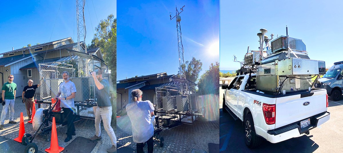
Their first foray started with a comprehensive air quality study by measuring air emissions from oil seep, as oil can emit Volatile Organic Compounds (VOCs) such as hydrogen sulfide, benzene, toluene, ethylbenzene, and xylene. For purposes of the study, they are installing monitoring equipment on an air quality, weather, and gas monitor tower in Summerland, location TBA.
The SOMS study will determine the most logical and efficient approach to capping the leaking wells by helping to reveal all the connectivity between wellheads, oil, and water reservoirs beneath the Earth’s surface. This is guided by compiling a Graphical Information System (GIS) database to evaluate, strategize, and prioritize mitigation efforts for well abandonment.
In mid-December 2023, Leifer and Rabin wrote a brief about the SOMS project, published at AGU (Advancing Earth and Space Sciences Group) online, see 411.
Titled, “OS24A-04 Anthropogenically-Modified Seepage and Leakage from the World’s First Offshore, Abandoned Oil Field, Summerland, Southern California,” it spells out the areas of the petroleum hydrocarbon reservoirs, the fault lines, and oil drilling timeline from 1877.
Pertinent excerpts are:
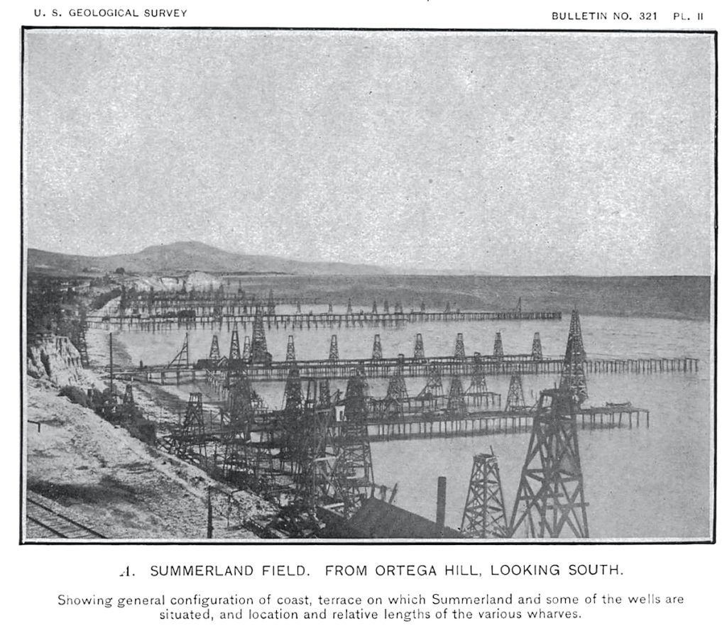
“1. The first onshore wells date to 1877; offshore wells began to be drilled 1896-1899 into natural seepage, with ultimately hundreds of wells (Fig. 1, from Arnold, 1907) drilled by up to 22 companies on nine oil piers extending over the ocean, long since gone by the early 20th century. These companies left a legacy of poorly and improperly abandoned oil wells that continue sporadically leaking oil and gas in the context of natural seepage, leaks that will continue in perpetuity, previewing the global legacy from millions of U.S. wells alone.”
“2. Many factors affect both the leakage and seepage (including anthropogenically-enhanced seepage) emissions’ spatial and temporal variability and heterogeneity, including geology and engineering (wells, re-abandonments), unconsolidated sediment layers, tidal pressure changes, wave-forcing, storms (and seabed scouring/build-up), and reservoir pressure including from multiple aquifer layers some of which connect onshore.”
Their remedial plan includes, “…novel approaches to mapping and quantifying seep and leak emissions for this ultra-shallow, coastal/swash-zone seepage, including on-water mapping, ROV [remote operated vehicle] surveys, water sampling, repeat UAV [unmanned aerial vehicle] surveys, review of available geological data, air quality surveys, magnetometer surveys, beach survey data, and direct seep capture.”
Ultimately with the mapping, novel remedial work, the goal is to guide policy development to reduce environmental impact.
411: https://agu.confex.com/agu/fm23/meetingapp.cgi/Paper/1434984


