
MFPD Approves Evacuation Study
Last Friday, July 22, the Montecito Fire Protection District Board of Directors was given a presentation by Chelsea Richer of Fehr & Peers, a consultant company hired by the District to conduct an in-depth study of the District’s evacuation plan. The study took hundreds of hours over 10 months to complete and provided the District with a scientifically valid analysis of the evacuation challenges in Montecito.
Montecito Fire Chief Kevin Taylor tells us the need for the study followed the devastating outcome of the Camp Fire in Paradise, California, which started on November 8, 2018, and caused 85 civilian fatalities, several of which occurred while people were evacuating the flames. “Paradise was the first community in California to conduct an extensive evacuation study over fifteen years ago,” Chief Taylor said. “Districts throughout California looked at their evacuation study as the gold standard, and it was what we all strived for. It served as the framework for every evacuation plan in the wildland/urban interface in California. Unfortunately, in the Camp Fire, given our new norm in fire behavior, we learned that that evacuation plan didn’t work. Several community members tragically lost their lives as a result of that fire, and we don’t want that here.”
Montecito has been evacuated 10 times since the Tea Fire due to life threatening wildfire and debris flow events. According to Chief Taylor, these events provided the District with information that informed the existing Evacuation Plan, but the plan does not consider spatial analytical methods like spatial statistics, critical cluster optimization, and traffic simulations.
The study included four key components: critical review of 18 evacuation after-action reports across California; a community survey with 118 Montecito resident responses; interviews with police and fire subject matter experts; and traffic operations modeling to identify locations where congestion accumulates on our roadway network.
Information gleaned from the after-action reports indicated that communication, messaging, and information sharing was inconsistent; destination shelters were unprepared and hotels lacked capacity for evacuees; re-entry into evacuated areas was inefficient and with inconsistent messaging. According to Richer, survey responses from residents in Montecito showed the most significant evacuation concerns include the ability to return home, transportation, and road conditions limiting evacuations, and knowing the destination of where they are evacuating to. Respondents showed a high evacuation knowledge and willingness to evacuate, as well as a high confidence in sheltering in place if told to.
Five fire agency and law enforcement representatives were interviewed for the study, including four fire chiefs and one sheriff’s deputy. The purpose of the interview was to better understand mass evacuation from an Incident Command/boots-on-the-ground perspective from various jurisdictions, in order to prepare a more comprehensive evacuation analysis for the MFPD. Interviews included questions that addressed advanced planning efforts, public information and noticing, and post-evacuation and recovery.
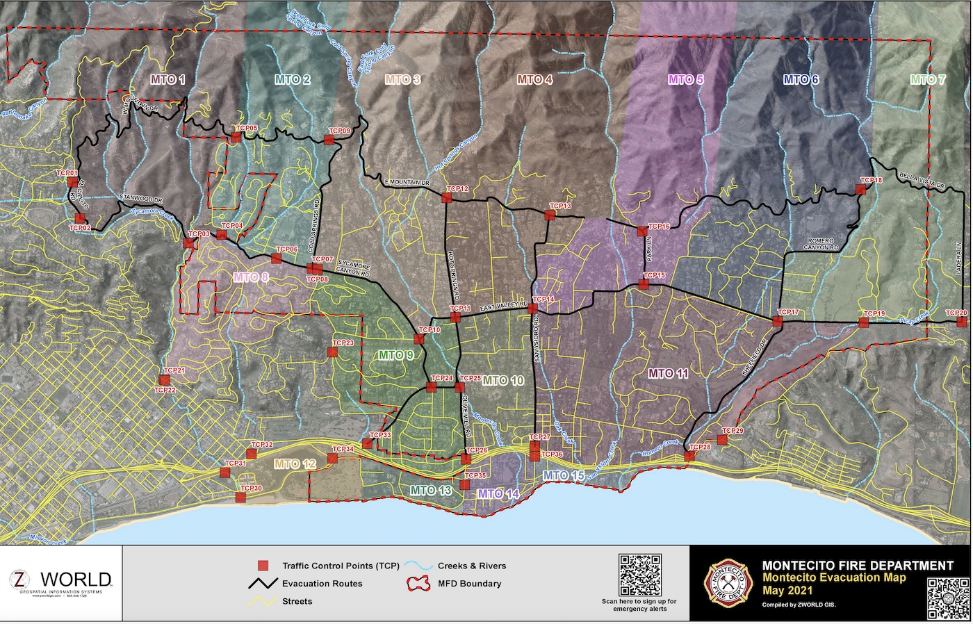
Traffic operations modeling considered two separate wildfire scenarios developed by staff using fire modeling software validated by recent experiences with wildfires on the front country of Santa Barbara County. Both scenarios included an afternoon evacuation order for three zones above Highway 192 with a corresponding evacuation warning for the three zones adjacent to the order zones. This level of order/warning is considered standard for a wind-driven wildfire in our jurisdiction, according to Chief Taylor, who later told us it would be unlikely that the entire community would be ordered to evacuate at the same time during a wildfire incident. The modeling established evacuation flows that are realistic and take into account school traffic; the modeling works similarly to traffic apps that reroute cars when there is congestion. It concluded that there would be a spike in evacuation trips on top of heavy commuter traffic in Montecito during the first 30 minutes of evacuation, and congestion on local streets, back roads to Santa Barbara, Highway 101, and on freeway on-ramps. The modeling did not take into account three years of upcoming construction on two roundabouts and the freeway, which Board members voiced concern about.
The study offers the District several recommendations, divided into the categories of wildfire mitigation (strategies to help prevent wildfires, which the District is already employing), demand-side (strategies that influence when, how, and where community members evacuate), supply-side (strategies that influence the physical and operational roadway infrastructure that facilitate an emergency evacuation), education/outreach, and capacity building/coordination.
“I’m so beyond pleased with the results of this report,” Chief Taylor said. “It validated what we anecdotally believed to be true. The study provides us a scientific analysis of existing conditions, now it’s up to us to look at it from an operational perspective, to reduce the stress on existing infrastructure.”
Chief Taylor said that District staff will now utilize the study, which was formally approved by the Board of Directors, as a starting point on which to formally evaluate procedures related to evacuations. “Evacuation orders will be precise and based upon the current conditions, our messaging will be clear, concise, and consistent, and we will work with the Sheriff and California Highway Patrol even more as it relates to traffic control points,” he said, adding that the addition of a full-time Public Information Officer has been a positive move for community outreach.
District staff will also look deeper into the community’s evacuation zones, which was a recommendation in the report. Moving forward, the study may have an impact on increased density in Montecito; in August, Chief Taylor will be presenting to the Board of Directors regarding Senate Bill 9.
To read the study in depth, visit montecitofire.com, and click on the packet for the Special Board Meeting that occurred on July 22.
You might also be interested in...


