
Hey, Siri, Tell Us the History of the Global Positioning System
When you want to know where you are or how to get there from here, you just check your smart phone and there you are — but did you ever think about how that gets done? The Global Positioning System of satellites was put in place by the U.S. Air Force (now Space Force) and is probably the most useful hardware orbiting the Earth, aside from weather satellites.
Navigation before GPS was usually “dead reckoning,” where the “dead” was shorthand for “deduced.” You started from a known location, kept track of the direction you were traveling and your speed, and calculated the resulting location. Later came sextants (requiring accurate clocks) and later still low-frequency radio navigation like Loran, which allowed you to triangulate to fixed land stations. With those systems, you were out of luck if you were out of sight of a station.
Then, in the early 1960s, some smart engineers realized satellites could be used if their orbits were determined precisely and if the user had a receiver that could pick up their signals. But since the satellites were moving all the time, the user couldn’t just triangulate from the satellites. Instead, a code related to the time is sent by each satellite. The receiver then uses the multiple times of flight of the signals from each satellite to correct its own clock and determine its location. It’s an elegant solution that deserves every award the team has garnered over the years.
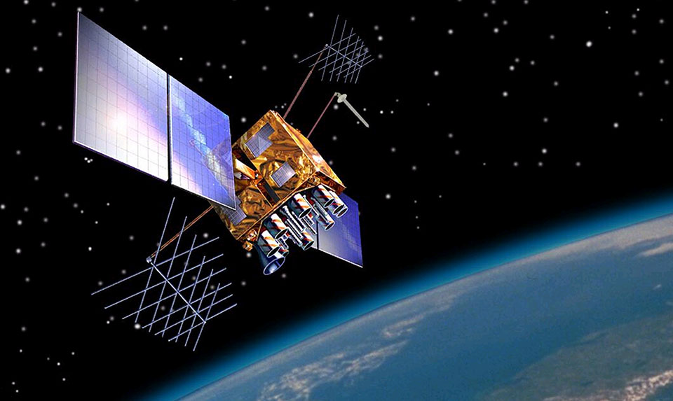
After more than 20 years of development and several early iterations of the system, the Air Force lofted 10 satellites over a period of seven years. As one of the early users of the technology for geological field work in far-away locations, I bought one of the early receivers which was about the size (and weight) of a brick. And because not all the satellites were up in those early days, we had to wake up at odd hours of the night to get a satellite fix. But in those days, it was like magic. Now you get a location fix on your watch at any time of the day or night. The current constellation includes more than 30 satellites orbiting at about 12,600 miles up.
There are some interesting “ifs, ands, and buts” about GPS. One I find most interesting is that Einstein’s Theory of Relativity must be considered. Didn’t think Relativity would ever affect you in real life, did you? It turns out that because the satellites are traveling at more than 8,000 miles per hour around the Earth, their atomic clocks run about 38 microseconds per day fast relative to clocks on the Earth. That doesn’t sound like much, but it translates to an error of six miles per day on the ground. Correcting for Relativity and for the atmosphere, your location can now be determined to about 10 feet.
A way was found to increase the accuracy even more over a region, however, and that was to go back to the days of a fixed land station, which then transmits a correction to receivers that are close enough. In the U.S., it’s called the Wide Area Augmentation System (WAAS); Europe has EGNOS. Surveyors sometimes set up their own local differential correction system by placing a beacon on a benchmark. Those corrections can get you down to a few inches in location accuracy.
Because the U.S. Space Force maintains GPS, it has occasionally denied the use of GPS during regional conflicts. But since GPS has become such a mainstay of our global way of life, other countries have set up their own systems: Europe has developed the Galileo system, Russia has GLONASS, and China set up Beidou. India and Japan have regional systems. The different systems are all compatible, though, and most modern GPS receivers can use signals from any of the systems. Because of the different names, an umbrella term was coined: Global Navigation Satellite System, or GNSS.
We’re all familiar with the common applications of GNSS: Our phones and cars tell us where we are and use digital maps to route us where we want to go. But there are a lot of other applications of the system. Last time I mentioned that fixed stations recording continuously produce time series of their motion caused by the drift of the tectonic plate they’re on. Arrays of these continuous GPS stations monitor the plates and the earthquake faults and volcanoes along some of their borders.
A consortium headed by NASA and the National Science Foundation called UNAVCO (www.unavco.org) hosts these freely available data, as do several other organizations. For my own work on land subsidence caused by groundwater pumping in the Central Valley, I consulted several continuous GPS stations to help calibrate the satellite measurements I made. Farmers use GPS to guide their field equipment and some of the equipment operates autonomously, following pre-programmed paths through the fields. The atomic clocks (corrected for relativistic effects) on board the satellites are used routinely for precise timing applications, such as orchestrating internet packets and stock market trades. Your phone and watch probably update their time using GPS.
The signals transmitted by the satellites can also be used as a “signal of opportunity” — by aiming a GPS receiver down rather than up, the reflection from the ground can be used to deduce soil moisture levels or snow cover amount. The reflected GPS signal of opportunity is also being used to measure wind speed over the oceans by a new constellation of eight NASA micro-satellites called CYGNSS. And if a special receiver is pointed at a GPS satellite near the horizon, the satellite’s transmission must go through a thicker atmosphere, yielding information about the structure of the atmosphere.
Looking straight up is another way to obtain information about water vapor as well as the activity of Earth’s ionosphere, which is very important for further refining location accuracy. Finally, many satellites unrelated to GPS carry their own receivers, so their orbits can be determined more accurately. This is particularly important for Earth-mapping missions, which need to accurately locate their data.
So next time you ask Siri or Alexa for directions to the nearest sushi place, thank the U.S. Space Force, NASA, and Albert Einstein for putting together the Global Positioning System.


