
Debris Basin Plans Move Forward
Following a November decision by the Board of Supervisors to negotiate with eight property owners on Randall Road and East Valley Road, Santa Barbara County Flood Control has started the environmental process to build a debris basin along the San Ysidro Creek channel, filing a Notice of Preparation (NOP) of Environmental Impact Report with the Board of Supervisors in February.
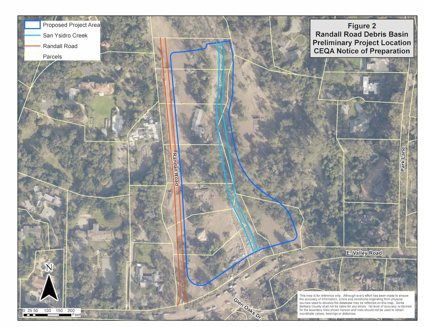
According to the NOP, which was submitted by Flood Control Deputy Director Tom Fayram and Public Works Director Scott McGolpin, the area of Randall Road, near Highway 192, suffered some of the most severe damage of the disaster zone from the 1/9 debris flow. Many homes and properties between Randall Road and San Ysidro Creek channel, as well as downstream, were destroyed beyond recognition and repair. The majority of the homes and infrastructure in the project area were destroyed and swept away during the disasters, and the project area is currently mostly bare rock, boulders, and sediment, with limited resprouting vegetation in the creek channel. Residential properties in various stages of damage, demolition, and re-construction are present in and adjacent to the project area, according to the FOP.
Preliminary design concepts for the proposed debris basin project include excavation to widen and deepen the property adjacent to the creek channel, upstream of the Highway 192 bridge/culvert, thus creating a catchment area to collect debris during storms and/or emergency events. A spillway or diverter structure may be incorporated into the channel to divert high storm flows and/or large debris into the excavated basin, while the central stream-channel would be configured as a natural creek channel through the main flow-line of San Ysidro Creek, retaining creek function and habitat similar to the surrounding watershed. Fish-passage components and natural habitat features would be incorporated as needed to protect habitat for native species. Appurtenant structures such as retaining walls, access ramps, fencing, debris racks, grading, landscaping/screening, walking trail, and vehicle parking, are also considered as part of the project design to be evaluated in the EIR.
Most notably, the project would require the purchase of several privately owned parcels and access easements or partial acquisition of adjacent parcels. The County is seeking $19 million in FEMA grant money to purchase the properties, agreeing to match $6 million in County funds to make the purchase happen. The negotiations have already begun, despite not having a clear answer from FEMA regarding the grant money.
The forthcoming EIR, which will take roughly a year to complete, will include environmental issues including aesthetics, air quality, cultural resources, hydrology and water quality, traffic/transportation, biological resources, geology and soils, and noise.


