
Lotusland Announces Opening of Japanese Garden

After over two years of extensive renovations, Lotusland has announced the opening of its Japanese Garden, which was originally created in the 1960s and is the only remaining post-World War II Japanese Garden that is open to the public on the central coast between Los Angeles and the Bay Area.
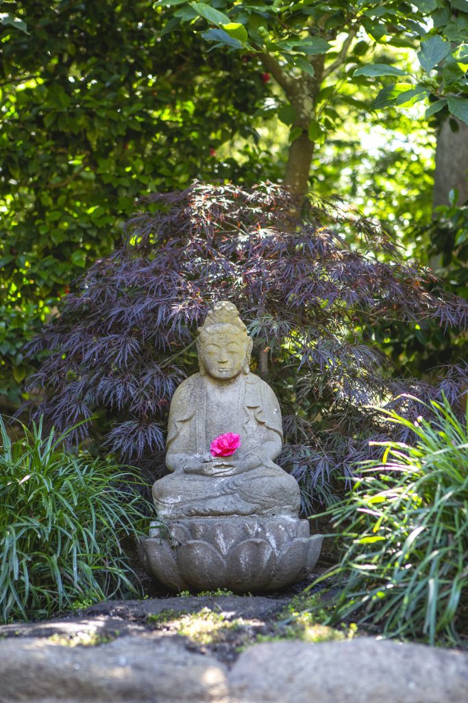
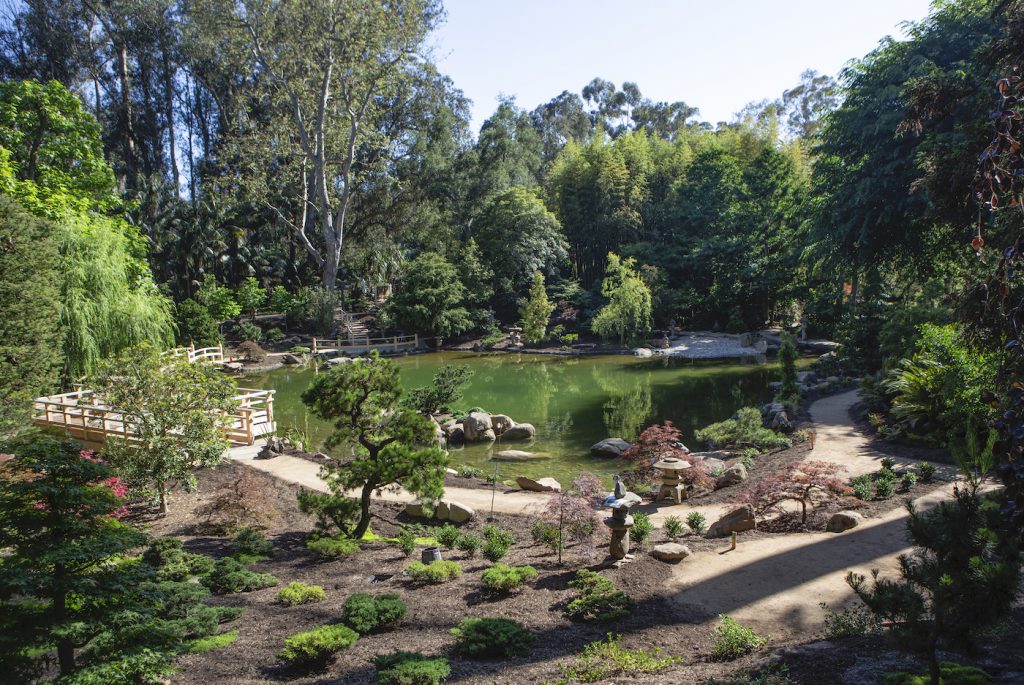
Construction began in February 2017, with a design intended to honor the original garden and vision of Madame Walska and Frank Fujii, who had guided the aesthetic of the garden both during and after Madame Walska’s lifetime for over 40 years. The $6 million renovation project was designed in conjunction with Lotusland CEO Gwen Stauffer, Derrik Eichelberger of Arcadia Studio, and Paul Comstock of Comstock Landscape Architecture. The garden is of the style of a strolling garden first constructed during the Edo Period (1600-1854), featuring a central pond or lake with paths going around it. The garden features the design technique called shakkei, to “borrow” a view or element of the larger landscape and incorporate it into the garden. The view of Montecito Peak framed by the Torii Gate is a perfect example. In addition, look for the many “hide and reveal” opportunities that are a cornerstone of the Japanese garden design aesthetic.
The renovation project improved the pond’s aesthetic and created gathering areas with seating for members and guests, as well as settings for Lotusland’s new wellness program. Features that were added after Walska’s death that were not in sync with her vision were removed, and new features that Walska or Fujii had planned but did not complete, such as the lotus viewing deck, were added.
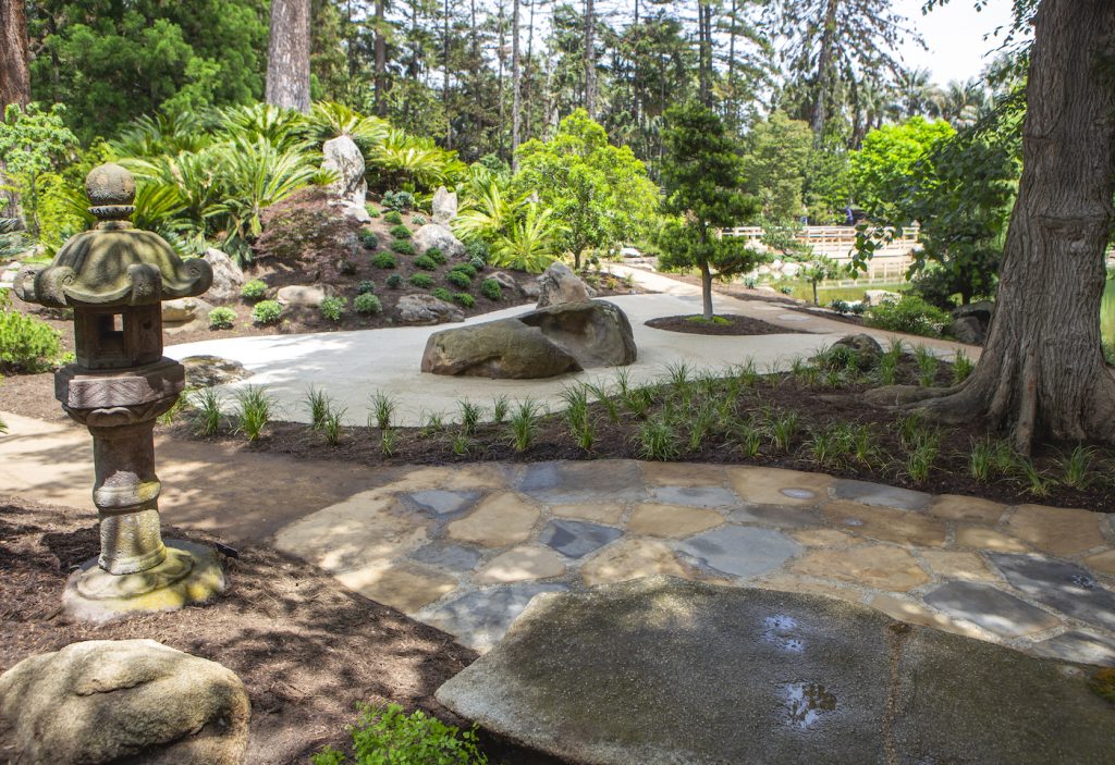
Other features include a gathering area and ADA accessible path into the garden from the Torii Gate, as well as the new Karesansui or dry garden with patterns raked into the sand. This addition was based on early garden photographs taken when Ganna Walska was still at Lotusland. A new space among the grove of Cryptomeria japonica (Japanese cedar), pruned in niwaki style, is called the Cryptomeria Gathering. This gathering area is adjacent to the newly restored waterfall and stream. A Spring Blossom Walk that will enable wheelchair access to the soon-to-be built Pavilion from the west side of the garden was also created; the path features flowering cherries. The designers added three new bridges constructed with yellow Alaskan cedar for posts and rails, and kala balau for the decks. Traditional giboshi (finials) finish the top of the main posts on the arch bridge by the reflecting pond’s overflow. The Miwatasu (Scenic Overlook) is a new gathering area offering a breathtaking overlook of the garden. This enchanting space has been created within the Araucaria forest and connects to the Japanese Maple Walk. The traditional Miwatasu gate at the entrance is made of yellow Alaskan cedar.
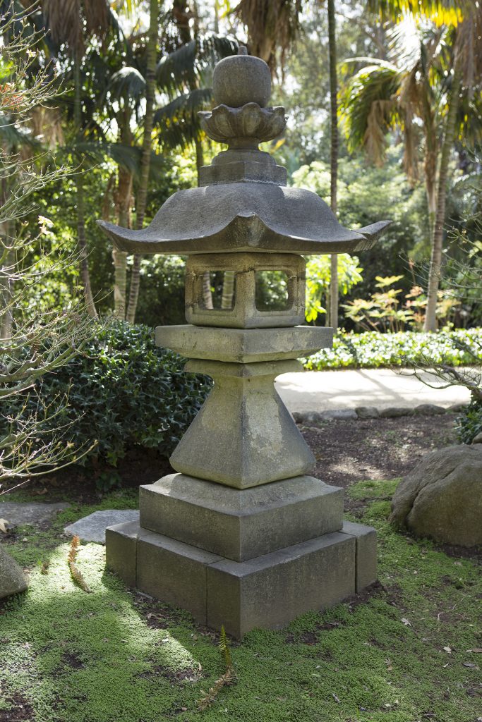
The collection of 30 stone lanterns (ishi-doro) and pagodas have been returned to their original positions in the garden. Walska collected these mainly from old gardens around Santa Barbara.
As a tribute to the resiliency of the community and the healing power of Japanese gardens, the boulder “benches” are Santa Barbara sandstone collected from the January 2018 Montecito debris flow. The garden includes 33 species of broadleaf trees; 38 species of conifers, two varieties of palms, one cycad species, 45 shrub species, five types of bamboo, 13 varieties of ferns, 30 varieties of herbaceous perennials, and six varieties of aquatic and bog plants.
The Garden will be officially debuted at Lotusland’s upcoming gala, dubbed Lotusland Celebrates: Memoirs of a Garden. Attendees are invited to enjoy the magic of Lotusland as they get an exclusive tour of the newly renovated Japanese Garden. The gala, which marks its 24th year, features a different theme every year, according to Strategic Partnerships Manager Sarah Haselschwardt. “The gala brings in a significant portion of operating budget,” she said. “The gala is always a unique event, uncovering certain areas of our 37-acre garden that haven’t been seen before.”
A structured garden walk will kick off the event, which will showcase multiple forms of Japanese-inspired entertainment along the way. On the main lawn, a lavish al fresco dinner by Duo Catering will be served, followed by a live auction led by the Vice Chairman of the Fine Arts Division at Sotheby’s, August Uribe. “It is an incredible honor to have him here, auctioning off these incredible items,” Haselschwardt said. The seven auction items include a moonstone necklace designed by Irene Neuwirth, luxury trips to Italy and New York City, an opportunity to hold a special event at Lotusland, and several other items, including the opportunity to have naming rights to a five-foot-tall Japanese lantern installed in the garden. “It’s a unique way to be a forever part of Lotusland,” she said. The event is being planned by chairs Belle Hahn, Setenay Osman, and Nati Smith and vice-chairs Oz Arconian and Winnie Dunbar, as well as a large event committee and production team.
While the gala, which takes place the last Saturday in July, is sold out, auction items can be bid on remotely during the event. For more information, visit www.lotusland.org.
Map to be Revised
As mentioned briefly in last week’s Village Beat, Montecito Fire Protection District has formally announced that the Debris Flow Risk Map is being updated to reflect several positive changes that have occurred in our community over the past twelve months. The MFPD, in partnership with the Santa Barbara County Office of Emergency Management (OEM) and the Carpinteria Summerland Fire Protection District, have engaged Atkin’s Engineering to update the Debris Flow Risk Map.
The most current version of the Debris Flow Risk Map was published in late Fall 2018 and is available at www.readysbc.org. Atkin’s Engineering is very familiar with the South Coast, according to Montecito Fire Chief Kevin Taylor. The firm developed last year’s Debris Flow Risk Map and the FEMA Interactive Recovery Map.
The purpose of the Debris Flow Risk Map is to identify properties in our communities that may be at risk from a catastrophic debris flow; it is utilized by local emergency managers to determine what portions of the community to evacuate when high intensity, short duration rainfall is forecast by the National Weather Service. The watershed that produces debris flow continues to regenerate and recover from the Thomas Fire, providing much more soil stability, according to officials. The creek channels and debris basins have been improved and widened by Santa Barbara County Flood Control District to provide a more direct route to the ocean, and our communities benefited from these improvements during the most recent storm season when all the debris stayed in the channels. Additionally, Debris Flow Ring Nets have been installed in three canyons by The Partnership for Resilient Communities, enhancing our community’s safety by catching and holding debris before it reaches populated areas.
According to Matt Pontes, Interim OEM Director: “The updated Debris Flow Risk Map will provide emergency managers with the latest, scientifically validated information to ensure that we are only evacuating those areas necessary when high intensity, short duration rainfall is forecast.”
“Given watershed regrowth, basin and channel improvement, our systems performance during the most recent storm season, and the addition of the debris flow ring nets, we are hopeful that significantly less community members will be impacted by the updated map,” Chief Taylor said.
Scientists will begin gathering data at the end of August 2019 and the map will be published in late October 2019. Community meetings and a door-to-door campaign of affected properties will follow in early November 2019.


