
Montecito Mudslide
On January 12 at 5 pm, I received media clearance at the corner of Coast Village Road and Coast Village Circle from the SBPD to view the large-scale Thomas Fire Flood rescue and clean-up operations along CVR through Olive Mill Road to Virginia Road. The SBPD asked that the MJ emphasize to all readers the importance of adhering to the mandatory evacuations and to not enter areas of Montecito designated as no entry; if you are in a voluntary zone and can stay out, that is also appreciated. This is to protect citizens, all manner of personnel working the hazardous areas and the town we love, and to help expedite the needed road clearance for the crews.
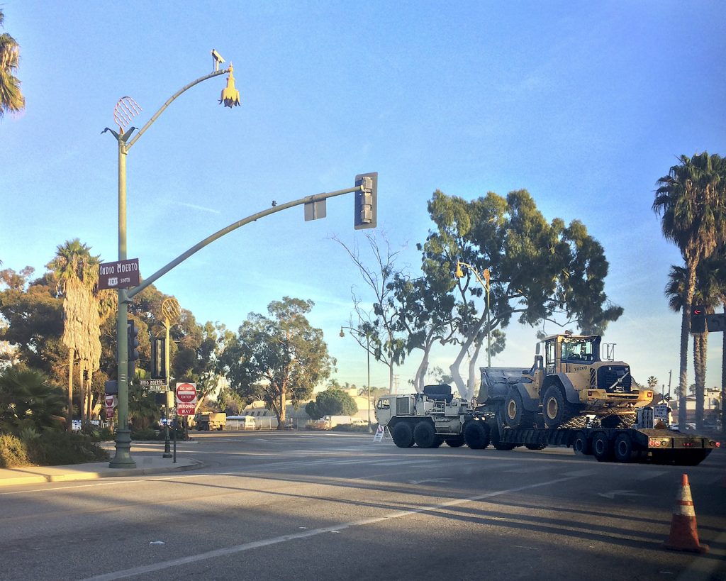
This update shows the closed roads and highway sections are being used by the Army corps of engineers, the national guard, SBC Sheriff Dept, SBPD, MFD, various clean-up tanker trucks, dog rescue teams, along with fire and police crews from all over California including Santa Barbara, Montecito, Kern County, San Bernardino County, San Juan Bautista, Mountain Home Village, utility companies and private HAZMAT cleaning crews for working on the Montecito Inn and Lucky’s Restaurant. The Chevron station on CVR was open to serve all these crews.
The second checkpoint for security is at Middle and CVR. The air is filled with visible and foul odor, brown dust from the dried mudslide that is mixed with the ash from the fire. I had an N95 mask but was not requested to use it. I wore wearing boots and other appropriate dress to be in the mud clean-up areas. As expected, the roads were bumper-to-bumper with massive trucks and crews; mud and debris were still present and being hauled away.
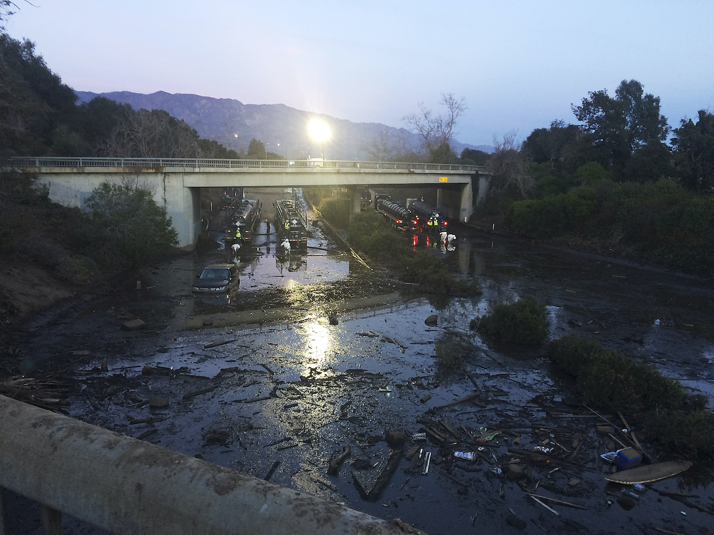
On the 101 freeway, sludge under the Olive Mill Bridge was still deep with a car, surfboard, wood patio signage, and other debris. HAZMAT-suited men with large tankers on both sides were sucking up the sludge. At dusk, the area was lit with large tungsten flood lights for the next shift crews to continue working.
After I covered the CVR area through Virginia Road, I met and talked with the fire crews at the Starbucks CVR parking lot, where they set up a hazardous waste area for the workers to get cleaned-up after working their shift, along with the dogs from the rescue teams. After the dogs are washed, they are fed, walked, and tucked for the night in individual doggie travel units. They mentioned that they had done sample testing for contaminants and did not have the results at the time of this report.
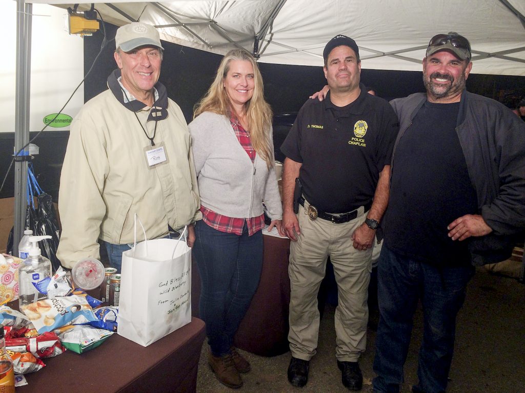
The Calvary Chapel’s Rob Laskin special project coordinator, Dana Klakeg, police chaplain Doug Thomas and his brother, Craig Thomas set up a white tent with chairs, warm lights, and were giving out fresh fruits, snacks, coffee, tea, and counseling services from the morning through 8 pm. A bus load of mostly elderly residents from the Bonnymede condos by the Biltmore had just been evacuated and brought here to the holding center by the Calvary Chapel tent to wait for rides to various shelter locations or to loved ones.
I texted the manager of the UPS Store on CVR for a mail and package update, and also spoke to the UPS center in Goleta. More than 4,000 UPS packages for Montecito are being security stored at the Goleta location and will begin to be sent to the UPS Store at 27 West Anapamu Street, Santa Barbara for pick up, along with any new mail.
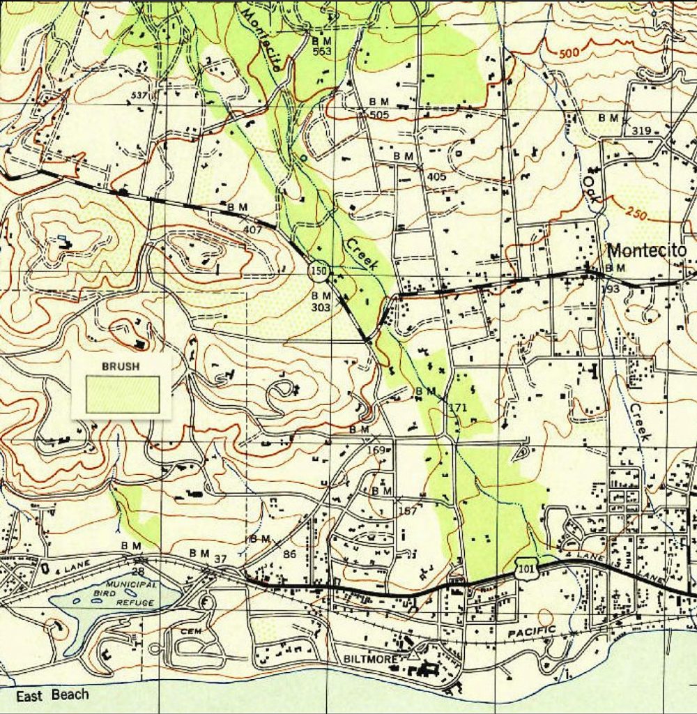
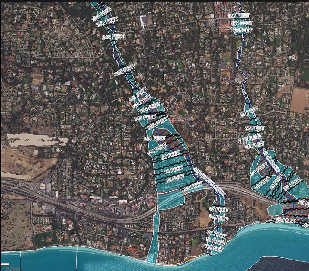
On January 10, Ryan Ausanka-Crues posted two maps of Montecito on Twitter with the following statement: “This map from 1944 and this FEMA map of flood hazards implies the Olive Mill corridor was an accepted flood plain until post-WWII. Also, note the change in path of #MontecitoCreek as it crosses East Valley/192. Path change directly corresponds to devastation.”
You might also be interested in...


