
There’s Bad News… And Good News
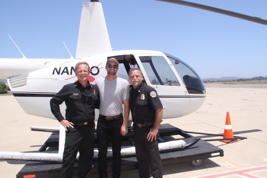
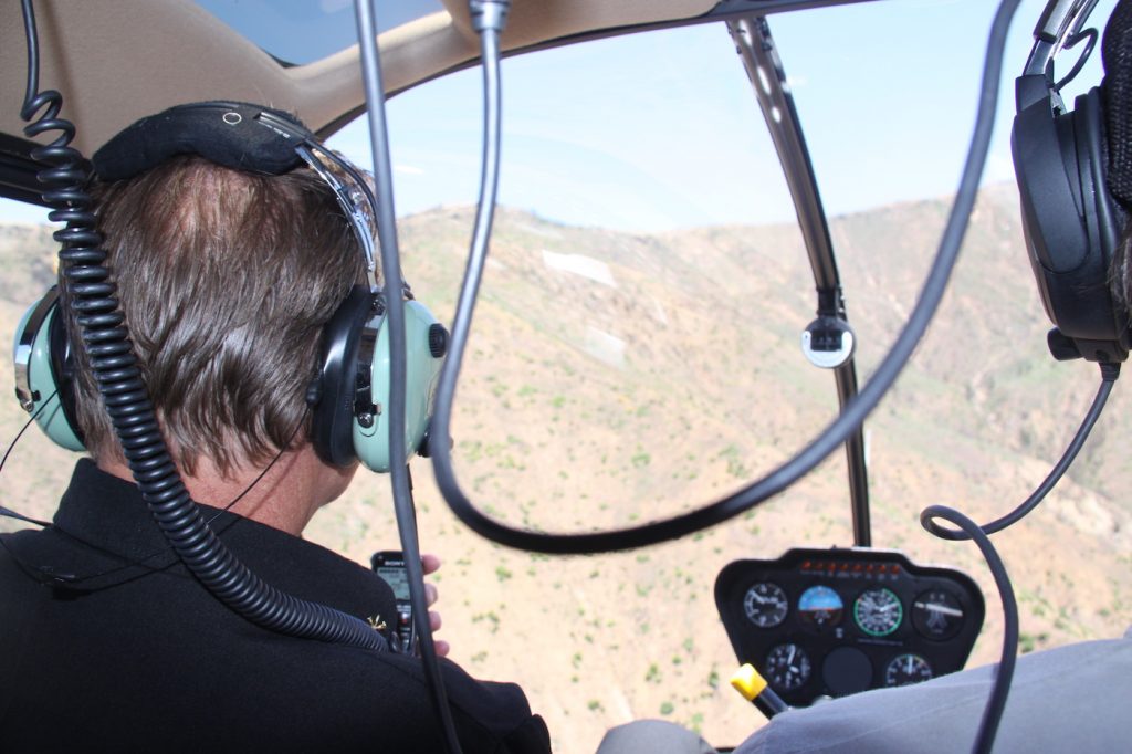
First, the bad news: “There’s plenty of material up here waiting to come down,” says Kevin Taylor, division chief of Operations at Montecito Fire Department. He says this as he, I, and Montecito Fire chief Chip Hickman examine the Montecito back country and the dry steep mountains directly above in a four-person, single-rotor helicopter flown by Nanco Helicopters founder/pilot Taylor Nancarrow.
The door is open on my side to facilitate photography. It’s noisy, less than spacious, but comfortable. We are all wearing headphones to communicate. Taylor is a reassuringly good pilot.
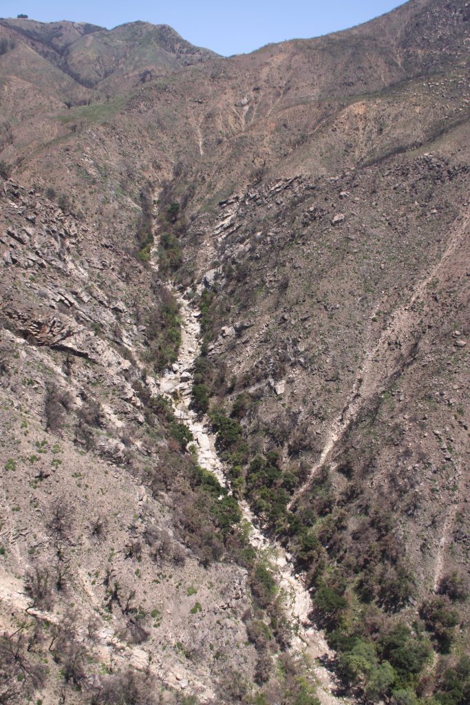
What we see, however, is less than reassuring. Boulders perched uncomfortably on steep slopes of mostly sandstone, with little vegetation – certainly no trees, oak, or otherwise – to hold them in the eventuality of what most professionals like to refer to as a “rain event.”
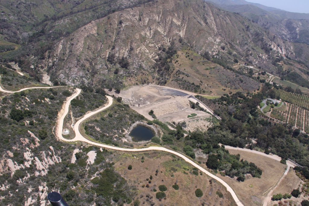
We pass over what Chip calls the “Triple Dip” on the Jackson Ranch: three small reservoirs of private water storage that firefighters use to “dip” their equipment into during fire “events.”
It’s good that they are there and even better that Mr. Jackson makes the water available.
“As long as the material doesn’t encounter an obstruction,” Kevin notes as we eye a series of rivulets that water runoff has used and will use to make its way down the mountain, “it will flow toward the ocean. If it does [run into an obstruction], with the volume of material there is,” he explains, “it’s going to start to fan out.”
Eventually, of course, the water finds its way to the sea. The rest of the stuff – the debris – stops along the way. “With a little bit of imagination, you can see how this all developed over the course of the last five thousand, ten thousand years,” Kevin adds.
I notice aloud about what seems to be regrowth in a green area below. “That’s the remains of the Tea Fire,” Kevin informs, “which acted as a ‘fire-stop’ during the Thomas Fire, California’s largest recorded fire.” The Thomas Fire took out 10 Montecito homes, along with a great number of homes in Ventura, others outside Ojai, and elsewhere. That the Tea Fire burn was able to stop the Thomas Fire points to one glaring observation: controlled burns over the years could probably have lessened both the extent of and the frequency of large fires.
We spot a collector that runs down into Cold Spring Creek. “It will pick up velocity to thirty-five or forty miles per hour as it heads down the mountain,” Kevin warns. “You can see how all these collectors converge into one of our creeks in Montecito.”
Yes, we can.
Re-seeding and Drainage
There are only four Montecito drainages – San Ysidro, Romero, Montecito, and Oak – and there are only four basins, and they’d need to be “two or three times deeper” to contain the amount of debris that could come down. “There’s plenty of threat up there to give us pause,” Kevin points out.
I ask about re-seeding and whether that could help alleviate some of the danger we are looking at.
“The last place where we re-seeded in Santa Barbara County was the Gap Fire,” Kevin replies, “but the scientific evaluation at the end was that it did not accomplish what they had hoped it would accomplish.”
The Tea Fire terrain is similar to what has now been denuded in the Thomas Fire. The drought has exacerbated the conditions, and there hasn’t been enough moisture to spur re-growth of what would be natural plant life.
What about debris basins? Can they be expanded quickly to catch and stop loose impediments?
“Debris basins are designed to capture large objects and allow the smaller stuff like water and sand to flow through,” Kevin says. But, since there is only about 12-percent regrowth at this point, the likelihood of another debris flow and/or even flooding is significant, particularly if Montecito experiences a five-inch rain over, say, a 24-hour period.
Our Basins are Clear
Something else to remember is that when the coast receives two inches, the mountains are likely to receive up to six inches and, depending upon how intense the storm is, could set off a chain reaction of falling boulders, debris such as tree trunks (though there aren’t many of those left higher up), ash residue, and fast-moving water, all of which will or can descend on their way to the ocean at speeds of 35 to 40 mph, producing flash floods and possible damage.
The good news is that the creeks have been widened significantly by the January 9 event and will likely contain most of the fall within the creek beds. A caveat is that private bridges and small culverts can easily become jammed with material. Once they do, of course, the spill can become dangerous.
Montecito does not seem to have a large enough separate area to develop and construct a $30-million project such as Carpinteria’s Santa Monica Basin, which successfully prevented a similar debris flow from rolling into Carpinteria, even if it had the money or inclination to do so.
The Conservation Corps with the help of Army Corp of Engineers (who also constructed Montecito’s debris basins, though on an “emergency” basis after the Coyote Fire) built the Santa Monica debris basin to handle a possible water and debris flow. “It was extremely effective this time around,” Chip says, but he doesn’t believe there has been a study to figure out what kind of engineering would be required to retrofit Montecito’s basins to hold the capacity of material in the watershed behind Montecito.
He does reassure, however, that “All of our basins are clear and have been cleaned out,” in preparation for the upcoming rainy season.
“We are entering into an intensive period of study with geologists and engineers trying to establish risk levels,” Chip counsels. “Some water courses might only have ten contributors, but some may have twenty-two. Right now, we have this half-inch-per-hour threshold, but we’d like to refine that and determine what is at risk with each tributary.”
A study is ongoing to look at the next rain year’s threshold. So far, there’s been less than 10-percent regrowth. “What we’ve got now,” Chip warns, “is all we’re going to have come the rainy season. He adds that we’ll need to have 50-percent regrowth before we can consider ourselves safe, so that may be as far as three years off.
The Parra Grande Situation
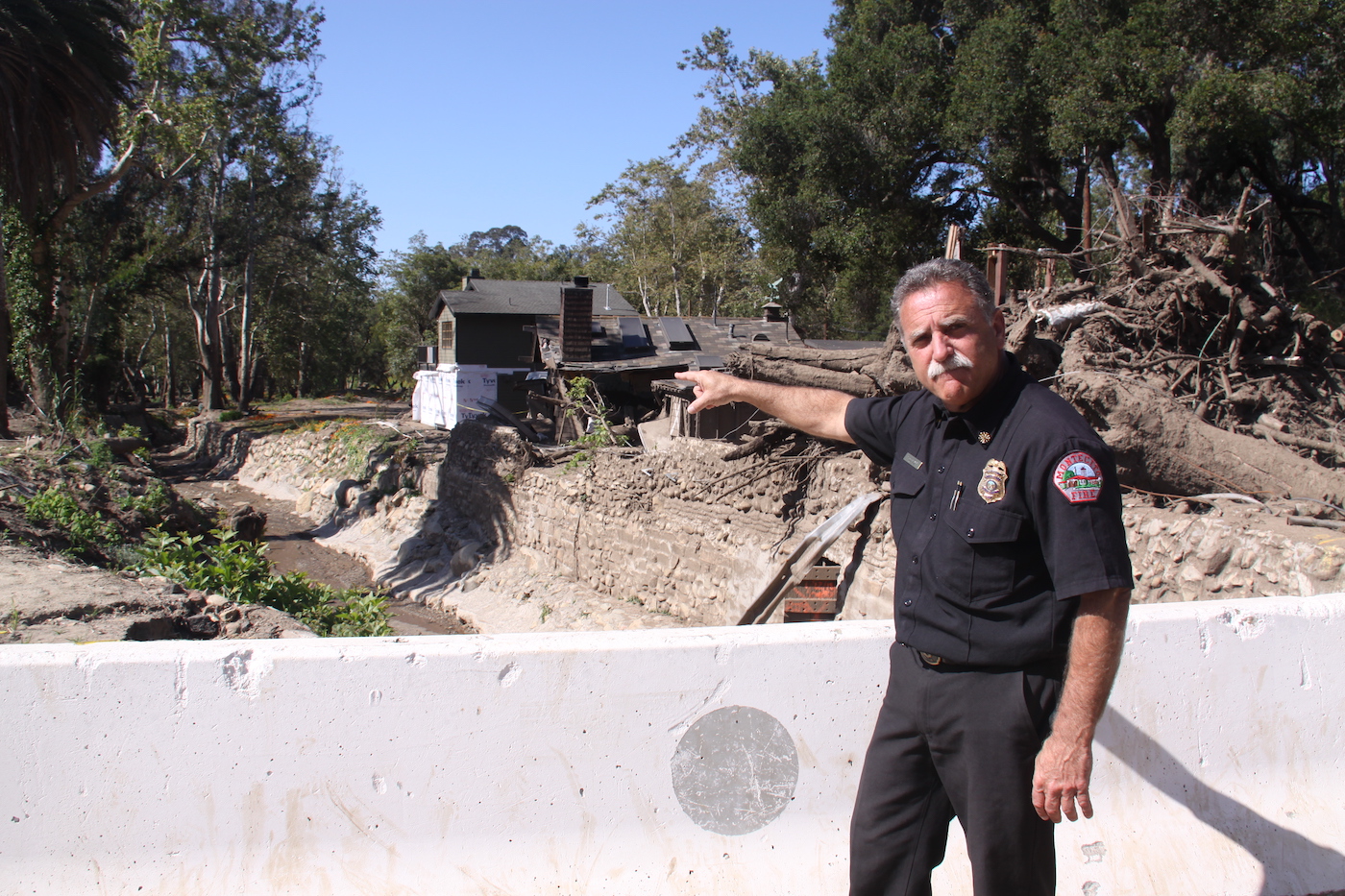
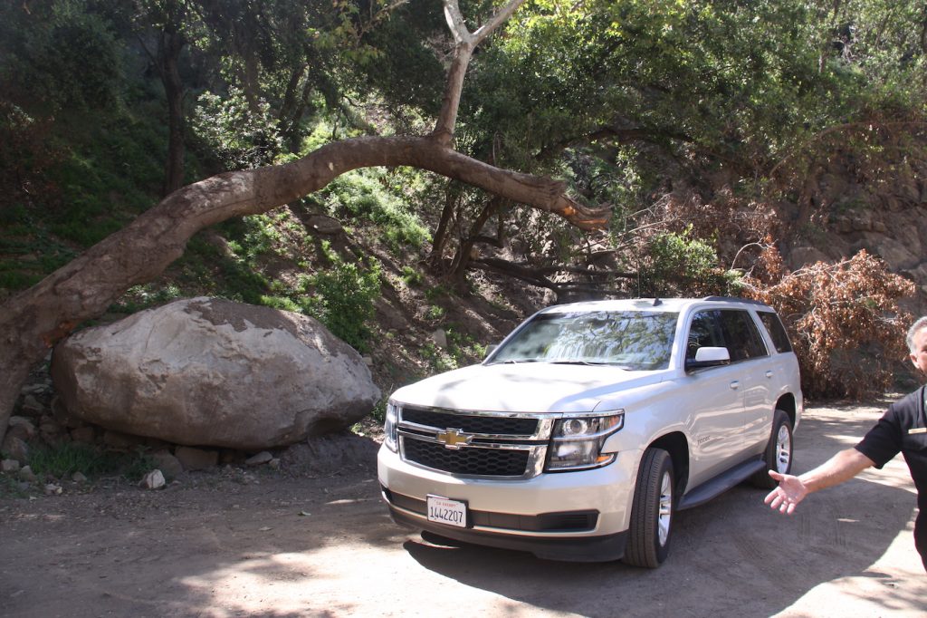
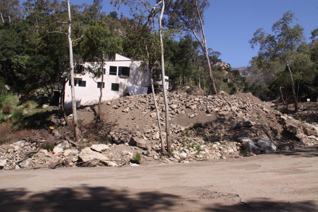
Days before going up in the helicopter, Chip and I drove Montecito’s back roads above Mountain Drive. Along the way, we stopped to see what progress had been made at the intersection of Parra Grande and East Valley Road.
Not much.
“The fire department had three homes on the property on Parra Grande: a one-bedroom, a two-bedroom, and a three-bedroom home,” Chip recounts as we gaze at the devastation.
The three-bedroom house, which was vacant at the time, was the old Montecito bar and was built in the late 1800s; it is completely gone, but the other two are still standing. The two-bedroom was occupied by a fire department employee who had to flee for her life. She couldn’t open the doors and had to go out a window with her husband, her daughter, and her two pets. “She proceeded to go up to the station and spent the next three days there as dispatch. It was a close call,” Chip says.
This area is where many of the deaths occurred and where the same water and debris made their way down Olive Mill, to Casa Dorinda, Montecito Oaks, to Highway 101 and eventually stopping near the Coral Casino and the Biltmore.
Just as a note: the female firefighter, her husband, her daughter and their two pets continue to search for a place to live, so if a reader has a rental, please give Chip a call at the fire station: (805) 969-7762.
Creek Flow Obstructions
There are at least 100 “pinch points” along the various creeks in Montecito. They could be anything from a turn, a bridge, and either a natural or manmade obstruction where water can spill out. “Some can be mitigated, some cannot,” Chip advises. He says too that he has “no idea if this water course (Montecito Creek) is in its natural state, but it’s not likely.”
According to records, these tributaries have come down and brought sediment throughout the Santa Barbara area. Rocky Nook Park is a prime example, as is the city of Santa Barbara and elsewhere. With enough sediment in the water, its specific gravity is no less than rock, so boulders move with the material because the material is much the same weight as rock. Velocity pushes it too.
Montecito experienced severe flooding in 1983, ’95, and again in ’98. In all those cases, there was no concomitant debris flow, just water and rocks. The January 9 event, however, was different.
“It was a perfect storm,” Chip notes. “The fire denuded the land including the roots of the trees. Then, you add a rain event that comes directly over the burn scar at the rate of .7 inches in ten or fifteen minutes. I’ve seen boulders the size of VW buses in ’95 but this was much worse, perhaps ten times worse.”
Pre-Positioning Fire Crews
Fortunately, Montecito Fire Department had pre-positioned resources that helped them rescue nearly “nine hundred folks” during those first critical 12 hours. “Had we not moved a swift water rescue team up from Long Beach and placed them in Montecito,” he says, “had we not set up a Search and Rescue Team… all fifty MFD employees were on duty, and placed in three pods. Nobody could come and help us, other than in helicopters…”
Is Montecito prepared for the upcoming rainy season?
“I can say this: When evacuation orders go out, people will need to get out of the way.” Chip also says he’ll be pre-positioning fire crews in the event of a forecast of a hard rain, “probably spending $250,000 a day to do so,” with 50 people on duty.
He says too that he and his team will be “surgically” making their decisions for evacuation by identifying properties lateral to the waterways, rather than linear (which makes sense for a fire, but not for a flood or debris flow).
Chip would like to have a good grasp of what the risk model looks like. “Our biggest hope is to provide as much safety as we can with the very minimal impact we can afford. We don’t want to displace people; we want to make an analysis based upon the best science available of what’s feasible, what’s timely, and what other agencies think is the best, including the Sheriff’s Department. We’ll have to secure the area until the evacuation order is over. We’ll have control points, then repopulation. There will be lots of decisions, such as when, how long, to what extent.”
Controlled Burns
Is there any serious talk about controlled burns?
“Yes, but obviously any time you burn standing brush, there is a risk you lose control of that burn. So, anything like that would have to be very well-calculated. There’s discussion about things of that nature. We have to make places where we can make a stand against wildfire. There was virtually no place where we could make a stand from Ventura to here [in the Thomas Fire] that was realistic. It’s probably because we tend to lean on the side of environmental impact. I’m not saying environment is not important, but when we can’t put fire breaks in because of environmental restrictions then… what does the environment look like now?
“A fuel break is not a passive thing,” Chip explains. “It’s a defensive line to work from, but it is an active part of the process of putting out fires. For forty miles between Santa Paula and the back door of Montecito, there was no opportunity to put out the fire. We need more fuel breaks in the future. They give firefighters a place to make a stand. What we do is put a bunch of bulldozers, a bunch of crews, we make a bunch of safety zones, we put a bunch of hose lines, we take big old aircraft – DC-10s and whatever we can get our hands on – and we treat the non-fire side, and we light that thing off with the hope that as the fire burns into the fire that we light that we are going to be able to hold that fire. That’s what works and it works quite well,” Chip expounds.
“And, that’s what happened back here,” he continues, “because Montecito had the presence of mind to put in some good fuel management behind, and we had a good fuel break at the top of El Camino. As a community, I think we need to look at making more fuel breaks to keep these things from happening.”
Who would be opposed to creating more fuel breaks?
Environmental groups are opposed to them. Other opposition includes chaparral advocacy groups, creek advocacy groups, forest advocacy groups, bird advocacy groups, I would invite some of those from the various groups to take a walk up San Ysidro Creek right now. Anywhere within the 280,000 acre-burn area. How many birds survived?
Swiss Nets
There was a meeting at the home of Susan and Palmer Jackson a week or so ago that served to introduce the Partnership for Resilient Communities, headed up by Brett Matthews, Joe Cole, Gwyn Lurie, Les Firestein, Pat McElroy, Mary Rose, and Alixe Mattingly.
During that meeting, Les pleaded that something should and could be done before the next rainy season. “Debris flows are fairly frequent events around the world,” he says. “There’s been something like nine or ten flows here in Santa Barbara over the past hundred or so years. I think it works out to one every eight or nine years, actually; this last one happened to be a humdinger. And there are going to be more. We know this.”
He suggests that rather than reinventing the wheel, Montecito should “import the global best practices and just… do those. We’re not powerless. We just need to get going. First off,” he suggests, “we need better monitoring. Better warning. And better evacuation. Where are precise instruments we can put up on the hill that will give us a lot better warning than we got on January ninth? It’s stuff you buy; it has no environmental impact; it goes in a box, and you put it on the hill. There’s also real-time computer modeling done by the geo-nerds that will give us a much better idea when things are ‘ready to roll.’
“Then, a huge one for us because we’re all saying, ‘What’s going to actually keep the rocks up there?’ is these Swiss steel nets that go in the creeks, basically a series of ridiculously strong – I call them brassieres – that catch the boulders and trees with the intent to decrease the volume and velocity of what’s coming down the hill. These things work and they’ve been deployed all over the world. They’ve even been deployed successfully as close as Camarillo, where they saved an entire development.”
Les says his group is working with the county to see if it can upgrade and supplement the existing debris basin network “because when they are adequately sized, they work.”
Another idea includes what is called Japanese Sabo engineering, “essentially a more rigid ‘debris rack’ closer to town. This is in contrast to the nets, which are most valuable in the hills, arresting the development of the ‘surge wall’ long before it gets going.” Other ideas include organically accelerating re-growth, capturing water better, keeping the mountains better hydrated.
As for the Swiss nets – or “flexible shallow landslide barriers” – they could be installed by November if we get on this now. These simple devices are made of re-enforced steel and are placed astride the various rivulets that lead to the creeks. During a rain event, they’ll collect whatever rocks and debris that come down and will fill up. After the storm, there are two options: emptying them ahead of the next rainstorm, or leaving the material in the nets to become part of the terrain, and installing new nets some distance from them.
The Danger Zone
How long before fire becomes a danger again?
“The Thomas Fire stopped at the burn scar of the Tea Fire,” Chip responds. “And, how old is that? (For the record, the Tea Fire took place in 2008.) The Thomas Fire did not significantly carry through that new field. It took some runs when things were really in alignment. Embers would fall out at the bottom of the drainage, and it would have enough heat in it to carry up the hill toward the homes along Coyote, so it would make some runs. But, even though we had down-canyon winds and the same relative humidity, the same fuel moistures, it would not continue to carry toward Sycamore Canyon Road. That tells you we have some time.”
What else can be done?
“Is there a better mousetrap, like a shaded fuel break that is more sustainable, such as a depth of oak trees two or three hundred feet deep instead of chaparral? We don’t want a big scar running across the mountainside. A lot of fires have stopped because of a change in fuel. The Gap Fire stopped because there were orchards along the front country. The fire ran right into them and stopped because they were hydrated.”
What We Can Do Now
So, without the Swiss nets in place, we’re still in danger?
“There’s plenty of material still up there,” Chip says. “The San Ysidro watershed is enormous. The creek above Ashley was perhaps twenty yards wide; it is now 200 yards wide. The mud level reached as high as twelve feet in the trees and ran out as much as 160 yards from the center of the creek.
“Conditions will incrementally improve, depending upon what kind of rain we get and how baked the ground is. There are places where the mountain is still completely bald, and elsewhere there is green vegetation. The soil is hydrophobic right now. If we get a big large event and then nothing for a couple weeks, that won’t do much.”
So, maybe after this rainy season we’re out of the woods?
“We have to plan on three to five years of dealing with this. We’re still going to be in the game three years from now. The potential is there for debris to come off the hillside if we don’t have vegetation holding it up. We’ve dealt with water, before but it was never washing hundreds of homes off the hills.”
The immediate solution, as we see it, is to contact Geobrugg and order up some of those “flexible shallow landslide barriers,” better known as “Swiss nets.” And to order them yesterday and to have them installed the day before. Note to Les Firestein: Let’s get on this now!
You might also be interested in...


