
Fire and Flood, Mud and Debris
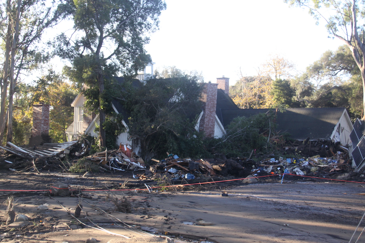
The catastrophic fire and flood of 2017-18 has changed the face of a number of parts of Montecito for years to come. The mud and debris flow that came down the mountains behind us tossed cars around like Tinker toys and ripped homes off their foundations, filling the landscape with toxic mud and mold. Many homes were completely destroyed, and many others sustained significant damage. But, and this is the good news, 90 percent of Montecito remains intact.
It is nearly impossible to describe the enormity of the disaster that befell Montecito beginning around 3:30 on the morning of Tuesday, January 9. Residents of the upper village, already faced with a loss of power that killed lights, computers, and phone service, tumbled out of deep sleep, awakened by a deafening roar that was rumbling down the mountain. The nighttime sky burst into a vivid orange-red panorama that suddenly illuminated the darkness, lighting the community as if it were mid-day instead of the middle of a rainy night.
Rudely awakened residents scrambled out of bed, imagining the worst from pelting rain, pouring down at the rate of a half an inch in just five minutes. A giant mudslide formed on denuded mountain slopes just below the Los Padres National Forest. Fire-baked foothills stripped of vegetation and recently ravaged by the Thomas Fire – the largest in California’s recorded history – covered a firestorm area nearly twice the size of the state of Rhode Island. Now, with concentrated rainfall, the mountain began to move.
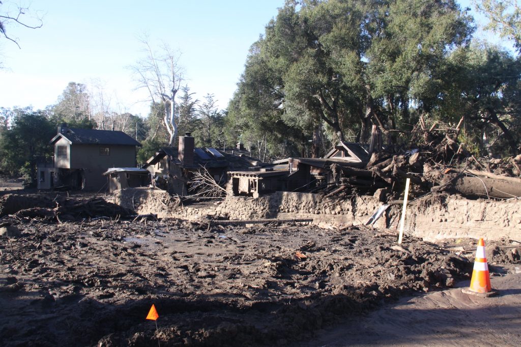
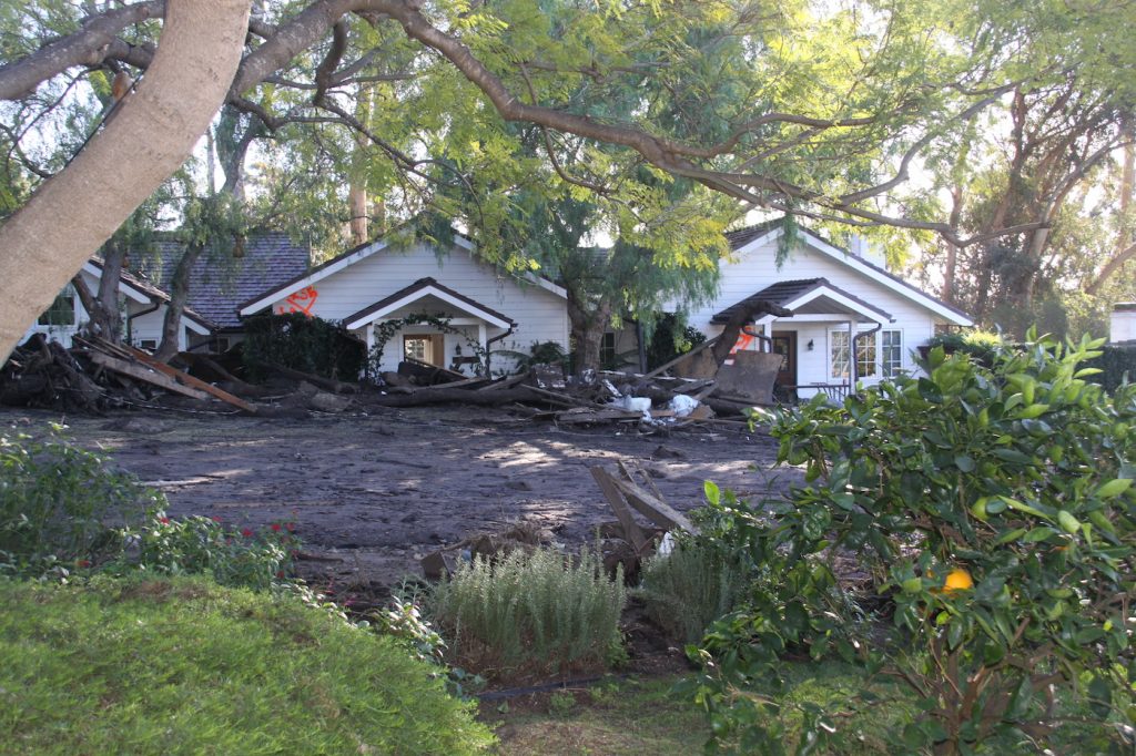
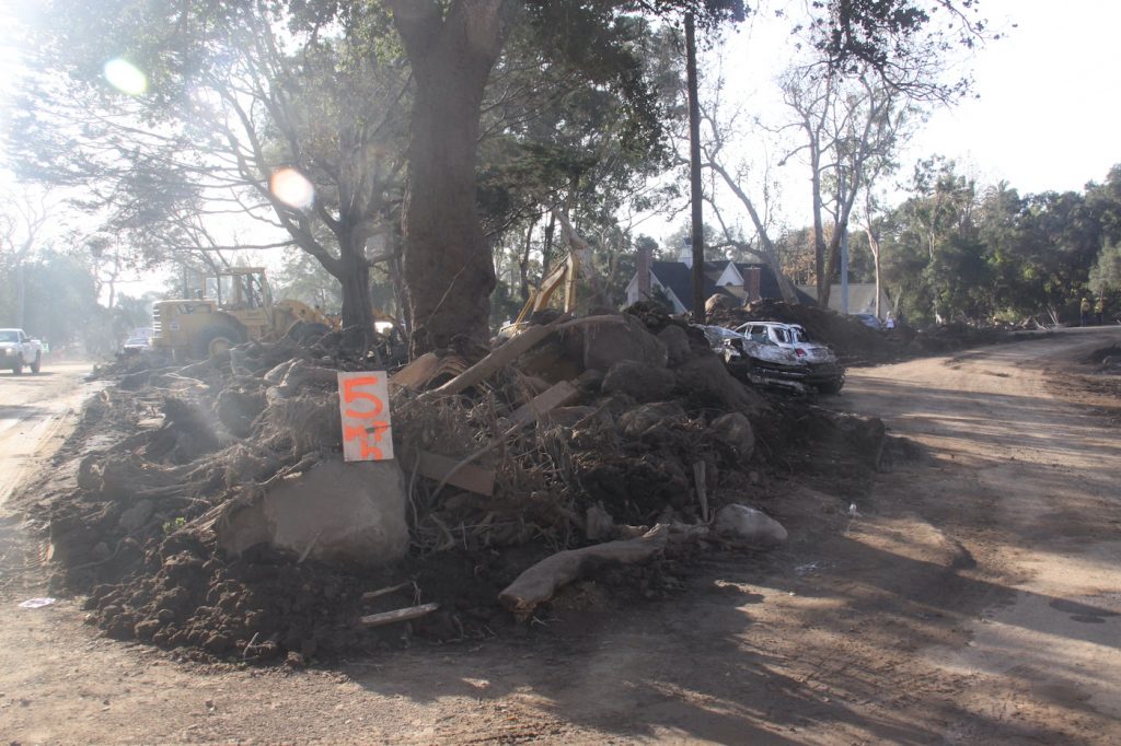
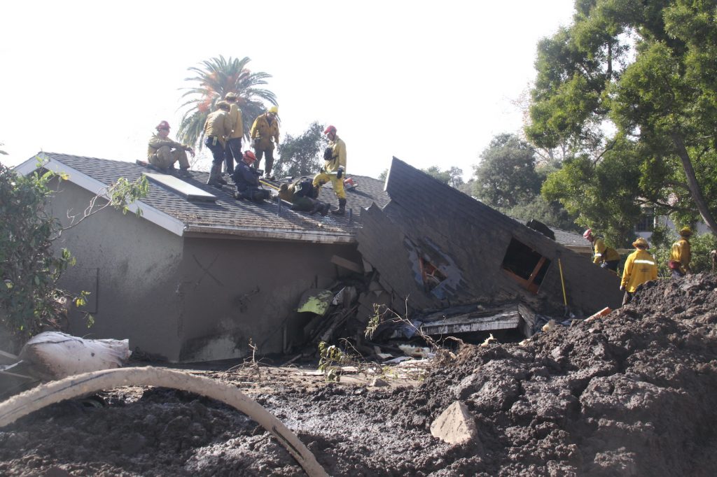
The rolling sea of mud and ooze, interspersed with giant boulders and uprooted trees that turned into river ramrods, snapped off power poles, destroyed homes or ripped them in half before residents had a chance to escape. Debris and devastation covered an area in Montecito far larger area than lower Manhattan, site of the World Trade Center calamity in New York City on 9/11/2001.
The sweeping mudslide severed an underground gas line, exploding into towering flames and incinerating homes near East Mountain Drive just west of the San Ysidro Ranch in the Casa de Maria area, where San Ysidro Creek descends from the San Ysidro Canyon and West Park Hill Lane. Within minutes, the 9-1-1 hot line lit up with residents begging for first responders to save them from death and devastation they sensed was about to engulf them.
Evacuation Warnings
A mandatory evacuation notice had been issued on Monday for all residents north of 192 (East Valley Road) from Sheffield Road-Ladera Lane on the east side to Hot Springs-Olive Mill on the west side. Reputedly, less than 20 percent of residents heeded the mandatory evacuation order, which warned of possible mudslides from La Conchita and Ventura to Carpinteria, Summerland, Montecito, and Santa Barbara. Perversely, most of the death and devastation occurred south of 192 in the voluntary evacuation zone.
Birnam Wood
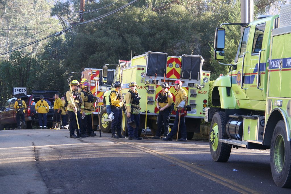
Some 40 cold and shivering victims, rescued by Montecito fire, in wet nightclothes and bare feet were deposited by first responders at the Birnam Wood Clubhouse, which had no staff and no power at 3:30 am. Responders, overwhelmed with calls of distress, had to get back to their search-and-rescue mission. Burn victims had been transported to Cottage Hospital.
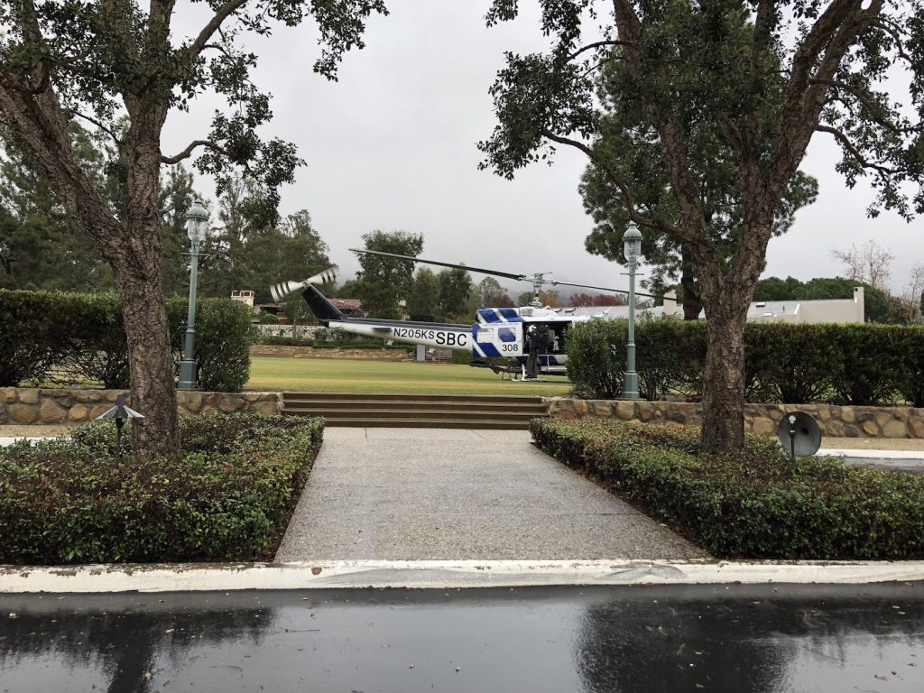
Nearby, awakened Birnam residents marshaled towels, warm socks, jackets, emergency lanterns, and limited food for huddled, frightened evacuees, who were finally permanently airlifted the next evening by a flotilla of National Guard helicopters, landing on the first and 10th fairways of Birnam Wood Golf Course, transporting victims to the UCSB emergency recovery center.
Hardest Hit
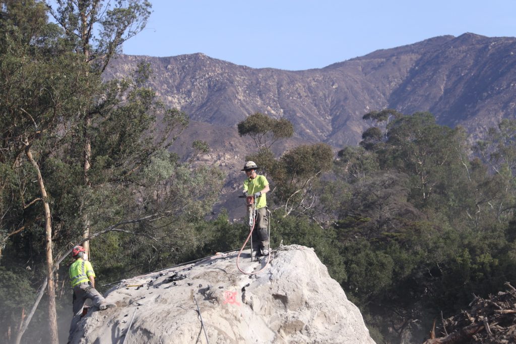
Predictably, the disaster was at its worst along the four drought-dry creek beds of Montecito that wind down through the canyons of the San Ysidro Mountains to the sea. The mix of water, mud, tainted ash, boulders, and debris that descended upon Montecito was destructive beyond comparison.
In order of severity of damage and loss of life, it is helpful to examine each of these flood plains that ripped the heart out of Montecito:
1) San Ysidro Creek and flood basin
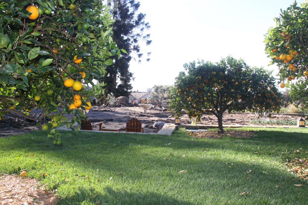
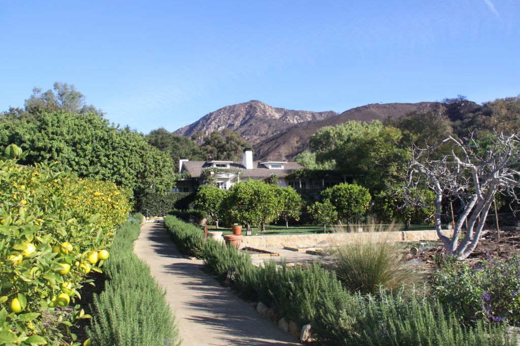
The San Ysidro Creek starts in the San Ysidro Canyon, above the San Ysidro Ranch at 900 San Ysidro Lane. That iconic resort had been selected as “#1 America’s Best Hotel” by Forbes Traveler, and #1 America’s Best Resort by Travel & Leisure. A good portion of it is now gone, and it will be years before the damage is repaired and the hotel restored. The Stonehouse Restaurant and Plow & Angel, selected cottages, the citrus grove, the chef’s garden, and the estate lawn were all severely damaged or destroyed by the sea of mud and boulders.
The San Ysidro Creek crosses under East Mountain Drive and descends through formerly lovely residential neighborhoods off Randall Road on the north side of East Valley Road and Glen Oaks Drive to the south. East Valley Road, at this location, was obliterated by a 60-yard-wide swath of raging water, boulders and masses of trees that crashed into homes, downed power poles, and washed away sewer and water lines. Noted oral surgeon Bob Kiken‘s home at East Valley and Glen Oaks was in its path, as was the home Montecito realtor Rebecca Riskin was staying in, just south of Dr. Kiken’s, and where Ms Riskin was killed.
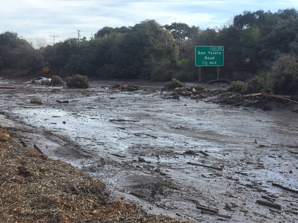
The swollen creek and its wide wave of destruction swept all the way down past Ennisbrook Drive to San Leandro Lane near Crane School, which was mostly untouched, and then down toward Tiburon Bay Lane where it destroyed a number of homes and wiped out North Jameson before turning the 101 into a river of mud; it then crossed the freeway and exited to the sea near Fernald Point.
2) Montecito Creek and Flood Basin
Montecito Creek originates out of Hot Springs Canyon, crosses Mountain Drive, descends past Riven Rock and crosses East Valley Road at Parra Grande Lane, just west of Hot Springs Road and east of Sycamore Canyon. Torrents of mud, boulders the size of an SUV, took out East Valley Road and most of the homes adjoining the creek, causing multiple deaths and sending unmoored homes crashing down the creek toward Hot Springs Road above Casa Dorinda. Multi-million-dollar homes on the west side of Hot Springs Road, West Pepper Lane, and Dinsmore Lane were seriously damaged or wiped out. The intersection of Hot Springs Road and Olive Mill was completely destroyed, including the entrance to Casa Dorinda.
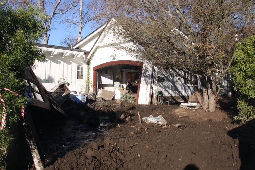
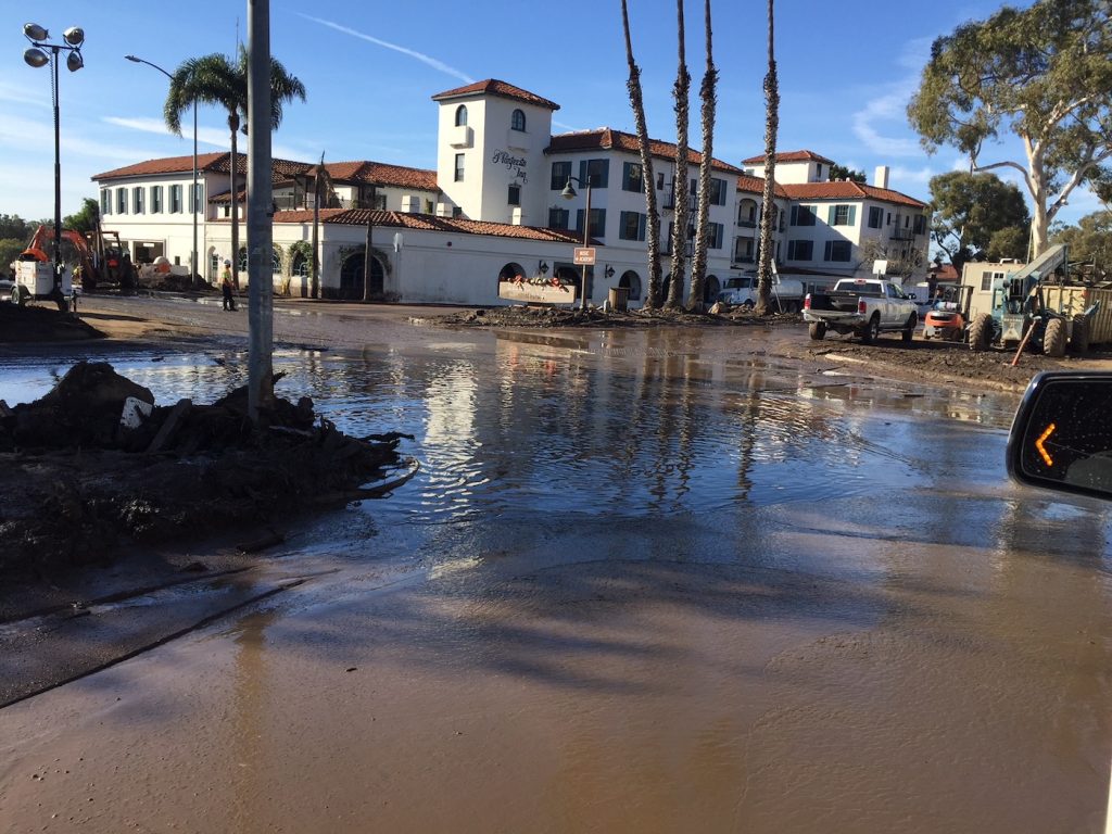
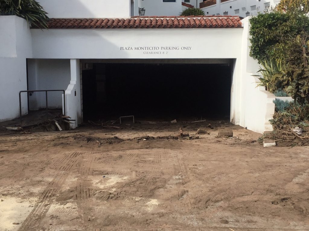
The deluge of mud, boulders, and broken homes continued to roar down Montecito Creek, wiping out homes along both sides of Olive Mill Road, powering its way through the modest homes in an area known as “Montecito Oaks,” before smashing into the Montecito Inn with boulders and mud destroying its garage and the cars parked therein, the intersection of Olive Mill, Coast Village Road, the entrance to the 101, and the 101 itself, closing Montecito’s vital lifeline to the outside world.
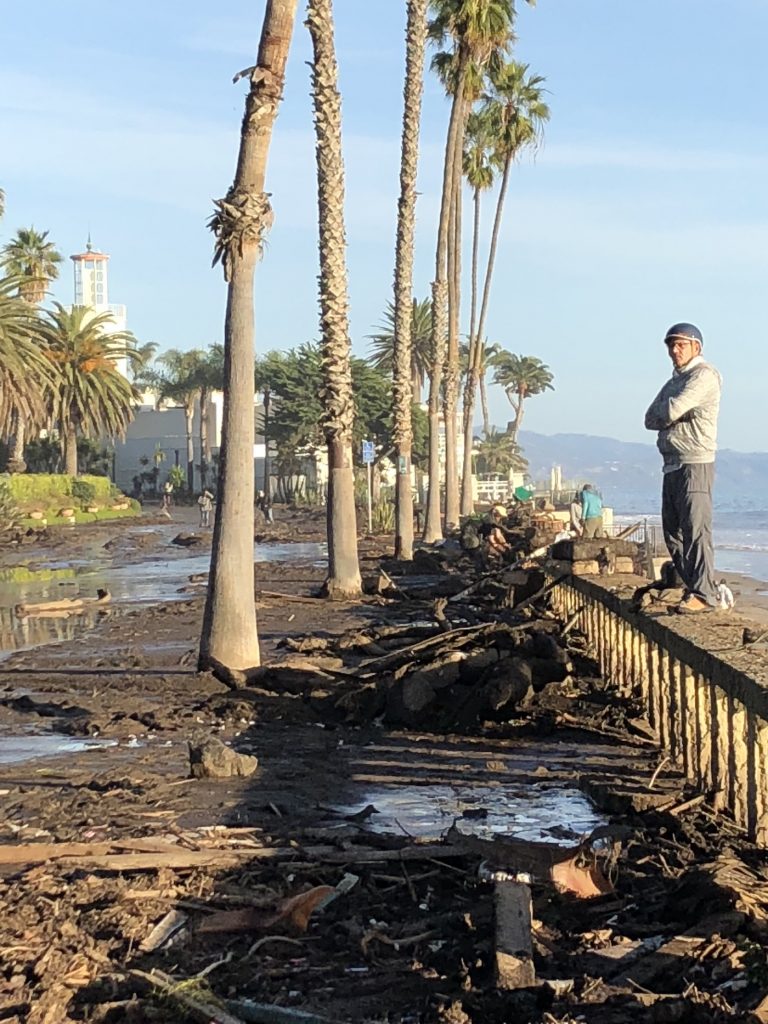
Tons of mud, water, and debris from a broken water main continued down Olive Mill, across the 101, wiping out the bridge railings, taking out the railroad tracks, parts of Bonnymede, Hill Road, the Biltmore and the Coral Casino on Channel Drive, before finally arriving at the ocean on Butterfly Beach.
3) Buena Vista Creek and Flood Basin
Less severe in terms of demolished homes and fatalities was Buena Vista Creek, which starts at the Buena Vista reservoir above Park Lane and winds its way down to East Valley Road near Tabor Lane and Romero Canyon Road. Homes were filled with mud and debris, cars were buried, East Valley was closed, as mud and ooze crossed East Valley and descended into the gated community of Birnam Wood on Boundary Drive and Las Fuentes Lane.
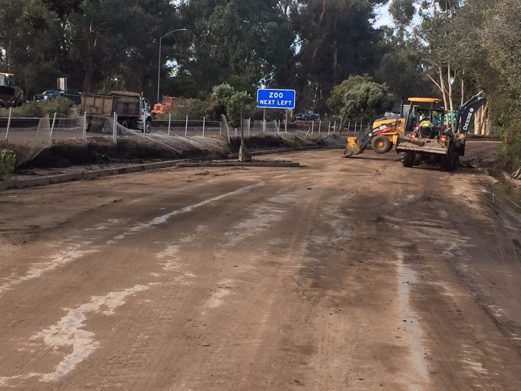
Sheffield Road was closed as an evacuation route, made impassable by mud, buried cars, and debris. It is now open, as is East Valley road (for recovery vehicles only), with chokepoints at San Ysidro Creek (Randall Road and Glen Oakes Drive) and at Montecito Creek (Parra Grande Lane).
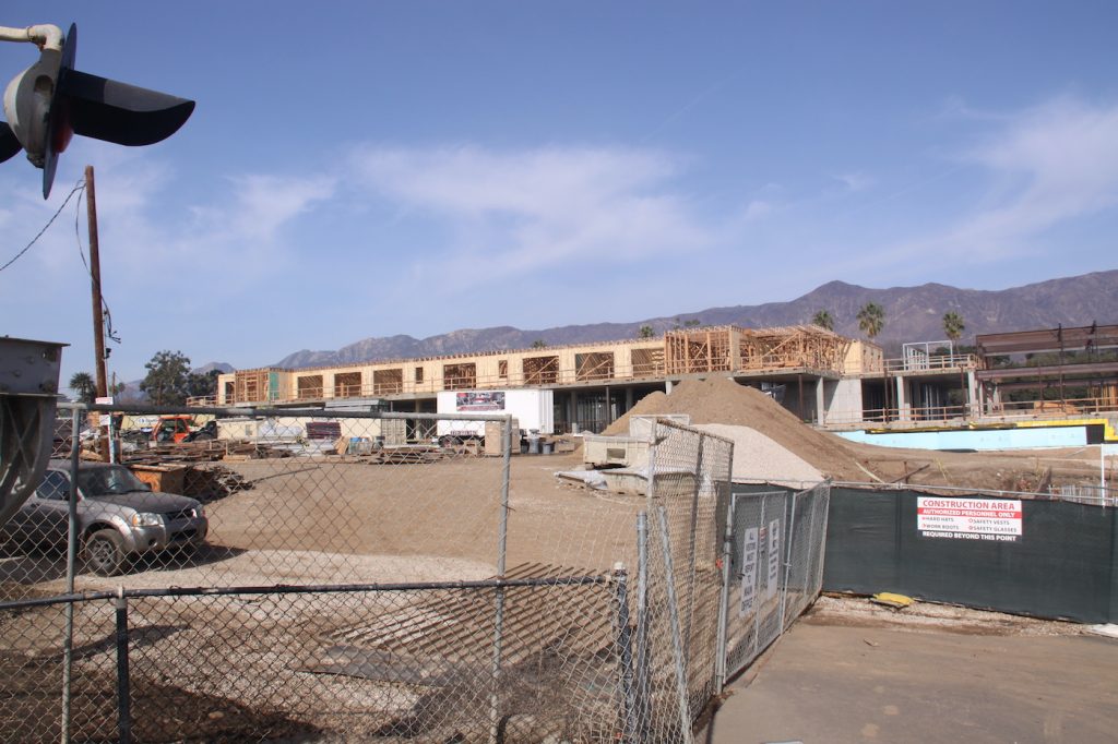
The upper village shops of Montecito remain relatively unscathed, dripping with mud, but structurally in good shape.
4) Romero and Toro Canyon Creeks and Flood Basins
Romero Creek, Elyse Creek, and Toro Canyon Creek carried mud and debris, closing East Valley Road at their crossing points. At one point, 300 residents were trapped in Toro Canyon but were safely evacuated in National Guard heavy duty trucks, Humvees, helicopters, or car caravans led out by first responders.
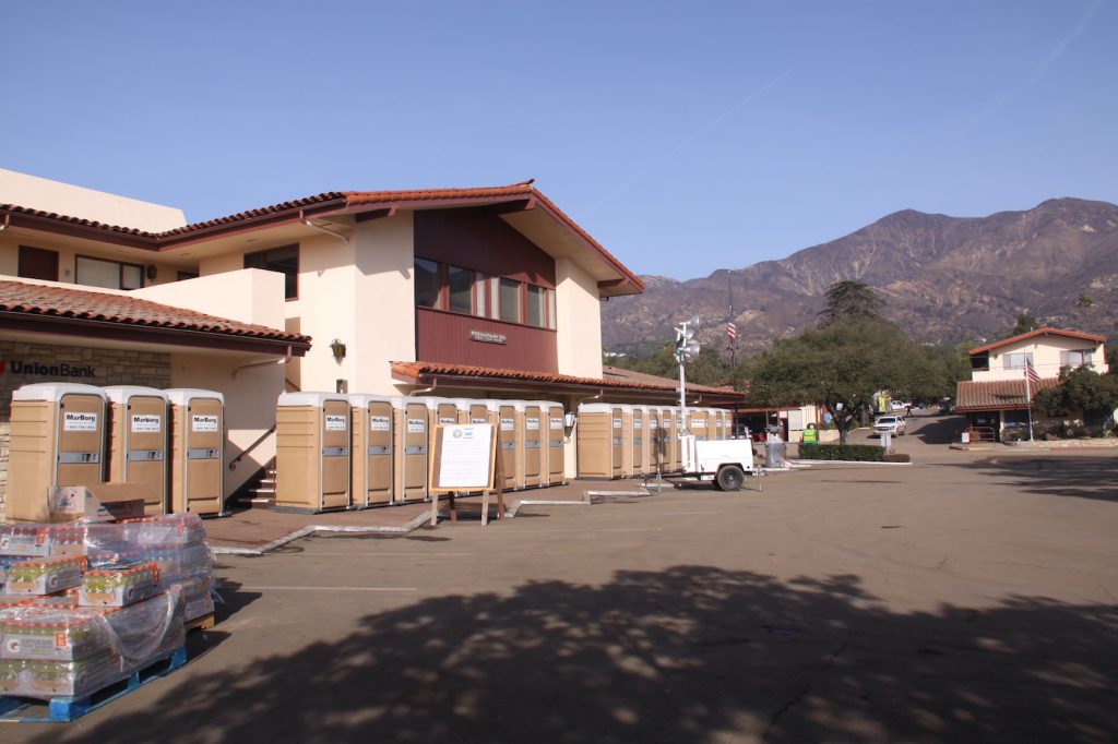
Recovery Information
To determine the condition of individual homes, Montecito residents are encouraged to Google an interactive map available at www.countyofsb.org/January-storm-info.sbc. Thirty-five percent of Montecito’s homes have been evaluated and assessed for danger. The map will be updated daily. By inputting address, color-coded displays indicate destroyed homes, seriously damaged homes, and those with minimal or no damage.
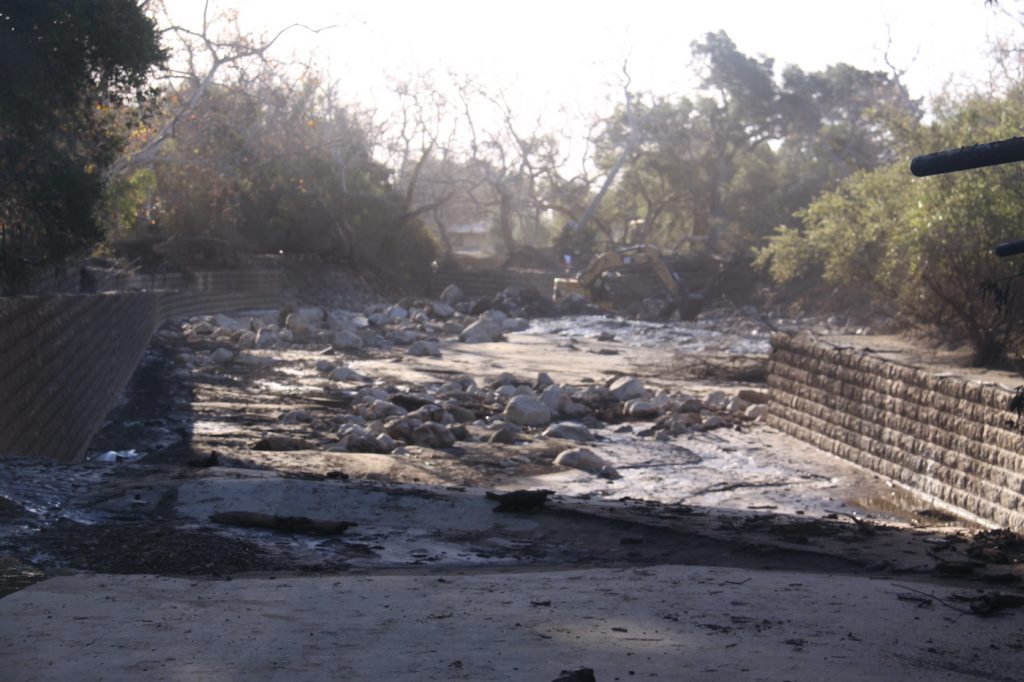
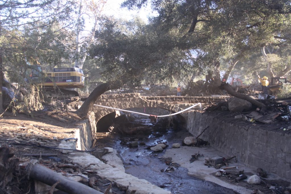
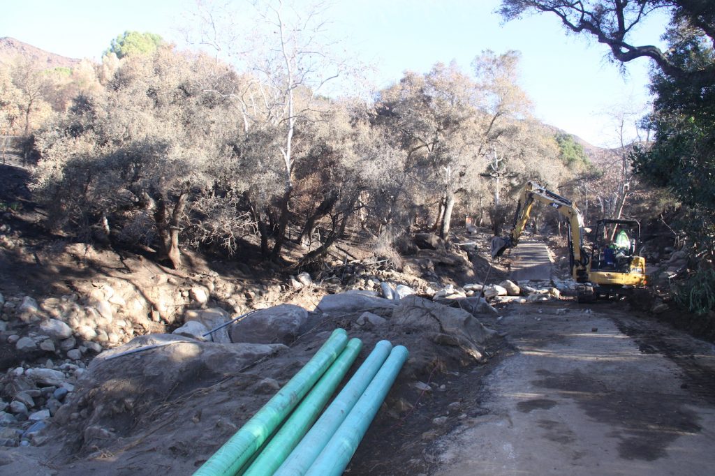
There are reports that nearly a million truckloads of mud and slime may have to be removed from Montecito. Where to dump toxic muck is an environmental challenge.
What Happens Next?
The most frequently asked question is: “When can I get back into my home?” The answer is: “No one knows.”
Estimates are hedged by the possibility of more rain next weekend, the condition of the sewer system buried under tons of mud, the quantity and quality of potable water that does not require boiling before being consumed, the danger from broken gas lines, the dredging and cleaning of creek beds, the clearance of storm drains, the structural safety of bridges and roads, the restoration of power and cable, and, most importantly, the toxicity of tons of mud and slime.
When will the 101 re-open? When will Coast Village Road shops and restaurants re-open? When will 192 East Valley Road re-open? When will the Upper Village shops and restaurants re-open?
Same answer. No one knows. The 101 remains closed southbound at Milpas Street and northbound at Highway 150. Caltrans crews pumping and scraping the 101 made slow progress last week because broken water mains poured in new mud and slime, replacing the extracted muck. New estimates indicate opening will be delayed for another week. Meanwhile, commuters are encouraged to use Amtrak or the Condor Express to go both south and north.
If pressed, my best guess is a full re-opening of most of Montecito by the end of February, barring another catastrophic rain event of moderate or severe intensity.
As disaster relief efforts transition from “Search and Rescue” to a full “Recovery” mode, the biggest obstacle is the threat that future rains may dislodge more mud and boulders from the scarred mountain burn area.
Sewer Systems
While the Montecito Sanitary facility, south of the 101 between the Music Academy and the railroad tracks, appears to be in reasonable condition, the same cannot be said for miles of sewer pipe that were once connected to destroyed homes, torn from their foundations, now under three to five feet of mud. Sewer service needs to be assessed.
The environmental danger from toxic mud and mold also needs to be re-assessed. Likewise, storm drains damaged by mud, debris, and trees need to be cleared, cleaned, and repaired.
The Good News
On January 15, Martin Luther King Day, it was reported that FEMA (Federal Office of Emergency Management) has designated the Montecito flood as wildfire related, meaning that residents with either fire insurance or flood insurance, or both, can file claims for flood damage and related expenses.
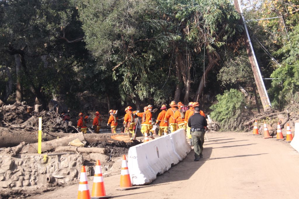
Once again, the response of thousands of first responders and heroic rescue teams, the cooperation of law enforcement and public safety responders, the disaster relief teams, the outpouring of local, state, and federal assistance, has to be experienced to be believed. Evacuated residents have no clue as to the enormity of the clean-up effort in our once-intact village.
Montecito residents can be exceptionally proud of Montecito Fire Protection District (MFPD) operations chief Kent Taylor, who was unexpectedly commandeered on the morning of January 9 to serve as incident commander to 1) find, identify, and extract fatalities; 2) mobilize the County Sheriffs’ Department, the California Highway Patrol (CHP) and the California National Guard to evacuate all residents of Montecito; 3) create a damage assessment plan to identify home damage, road conditions, bridge assessments, creek clearance and water, sewer, power, gas, electrical assessment.
We can never thank fire chief Chip Hickman enough and his crew for risking their lives to save ours in the first 24 hours. At the same time, they had to deploy and integrate resources from Cal Fire, County Fire, City Fire, mutual aid fire districts in Santa Barbara, Carpinteria, Summerland, Ojai, and Ventura, with other agency rescue and recovery teams from all over the state.
These agencies included the County Office of Emergency Management headed by Rob Lewin; County Flood control headed by Tom Fayram; Montecito Water District chief Nick Turner; Caltrans Jim Shivers; Montecito Sanitary; SoCal Edison; Southern California Gas; the American Red Cross; the Army Corp of Engineers and their contractors for creek dredging, pumping, and waste removal.
Other local heroes include County sheriff Bill Brown, a non-stop demon worker who guided us through both the Thomas Wildfire and the flood disaster, saving lives, evacuating the community, and protecting homes from looters.
Newly appointed executive director of the Montecito Association, Allison Marcillac, lost her home and all her belongings in the flooding, but continued to perform, according to Montecito Association president Charlene Nagel.
Bob Ludwig, president of the Coast Village Road Association, a doer, not a talker, quickly organized an emergency Coast Village Road community forum at the City of Santa Barbara offices, 630 Garden Street. Santa Barbara mayor Cathy Murillo; City manager Paul Casey; Public Works director Rebecca Bjork; and Montecito Water GM Nick Turner reported on recovery and clean-up efforts for Coast Village Road.
The Montecito Inn has already started on its own private cleanup of its buried garage. Others are beginning the process to hire local contractors to do the recovery work.
Where are We?
Being a part of a community recovery that is greater than ourselves is truly uplifting. Even though our homes, our cars, and our wallets may be temporarily broken, our spirits are strong. We are wounded, but we will heal.
You might also be interested in...


